- Search in all Repository
- Literature and maps
- Archeology
- Mills database
- Natural sciences
Advanced search
Advanced search
Advanced search
Advanced search
Advanced search

Object
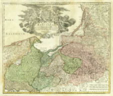
Title: Regnum Borussiæ Gloriosis auspicys Serenissimi et Potentissimi Princip. Friderici III Primi Borussiæ Regis March. et Elect. Brandenburg. inauguratum die 18 jan. A. 1701.
Contributor:
Publisher:
Place of publishing:
Description:
Skala [ca 1:800 000], podziałka liniowa: Millitaria Germanica communia 15 in uno Gradu ; 1 mapa : miedzior., kolor. ręcznie. ; 48x57 cm ; Południk Ferro, określony po obliczeniu współrzędnych przez katalogującego ; Podziałka liniowa również w milach polskich i rzymskich ; Opisano strony świata: Septentrio, Oriens, Meridies, Occidens ; Mapa pochodzi z: Atlas compendiarius seu ita dictus scholasticus [...] ; Kartusz rocaille zwieńczony herbem Prus, w polu tarczy rocaille jednogłowy orzeł z literą R [Rex] na piersi. Nad herbem zamknięta korona królewska unoszona przez dwa putta. Po obu stronach kartusza postaci Minerwy i Marsa ; Wydawca i data wyd. wg. : Prussia-Karten, 1542-1810 / Eckhaed Jäger, poz. 101
Detailed Resource Type:
Format:
Resource Identifier:
Source:
CBGiOŚ. IGiPZ PAN, call no. B.1644/51 ; click here to follow the link
Language:
Rights:
Terms of use:
Digitizing institution:
Institute of Geography and Spatial Organization of the Polish Academy of Sciences
Original in:
Projects co-financed by:
Programme Innovative Economy, 2010-2014, Priority Axis 2. R&D infrastructure ; European Union. European Regional Development Fund
Access:
Object collections:
- Digital Repository of Scientific Institutes > Partners' collections > Institute of Geography and Spatial Organization PAS (IGiPZ PAN) > Library
- Digital Repository of Scientific Institutes > Partners' collections > Institute of Geography and Spatial Organization PAS (IGiPZ PAN) > Library > Maps and atlases
- Digital Repository of Scientific Institutes > Literature > Maps/Atlases
Last modified:
Oct 2, 2020
In our library since:
Nov 21, 2013
Number of object content downloads / hits:
155
All available object's versions:
https://rcin.org.pl./publication/44936
Show description in RDF format:
Show description in RDFa format:
Show description in OAI-PMH format:
Objects Similar
Homann, Johann Baptist (1664–1724)
Homann, Johann Baptist (1664–1724)
Homann, Johann Baptist (1664–1724)
Homann, Johann Baptist (1664–1724)
Homann, Johann Baptist (1664–1724)
Homann, Johann Baptist (1664–1724)
Homann, Johann Baptist (1664–1724)
Homann, Johann Baptist (1664–1724)

 INSTYTUT ARCHEOLOGII I ETNOLOGII POLSKIEJ AKADEMII NAUK
 INSTYTUT BADAŃ LITERACKICH POLSKIEJ AKADEMII NAUK
 INSTYTUT BADAWCZY LEŚNICTWA
 INSTYTUT BIOLOGII DOŚWIADCZALNEJ IM. MARCELEGO NENCKIEGO POLSKIEJ AKADEMII NAUK
 INSTYTUT BIOLOGII SSAKÓW POLSKIEJ AKADEMII NAUK
 INSTYTUT CHEMII FIZYCZNEJ PAN
 INSTYTUT CHEMII ORGANICZNEJ PAN
 INSTYTUT FILOZOFII I SOCJOLOGII PAN
 INSTYTUT GEOGRAFII I PRZESTRZENNEGO ZAGOSPODAROWANIA PAN
 INSTYTUT HISTORII im. TADEUSZA MANTEUFFLA POLSKIEJ AKADEMII NAUK
 INSTYTUT JĘZYKA POLSKIEGO POLSKIEJ AKADEMII NAUK
 INSTYTUT MATEMATYCZNY PAN
 INSTYTUT MEDYCYNY DOŚWIADCZALNEJ I KLINICZNEJ IM.MIROSŁAWA MOSSAKOWSKIEGO POLSKIEJ AKADEMII NAUK
 INSTYTUT PODSTAWOWYCH PROBLEMÓW TECHNIKI PAN
 INSTYTUT SLAWISTYKI PAN
 SIEĆ BADAWCZA ŁUKASIEWICZ - INSTYTUT TECHNOLOGII MATERIAŁÓW ELEKTRONICZNYCH
 MUZEUM I INSTYTUT ZOOLOGII POLSKIEJ AKADEMII NAUK
 INSTYTUT BADAŃ SYSTEMOWYCH PAN
 INSTYTUT BOTANIKI IM. WŁADYSŁAWA SZAFERA POLSKIEJ AKADEMII NAUK


