- Search in all Repository
- Literature and maps
- Archeology
- Mills database
- Natural sciences
Advanced search
Advanced search
Advanced search
Advanced search
Advanced search

Object
Available formats:
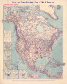
Download allTitle: Karte von Nord-Amerika (Map of North America) aus Sohr-Berghaus' Handatlas
Creator:
Bludau, Alois (1861–1913) : Redaktor ; Herkt, Otto (1885–1925) : Redaktor
Date issued/created:
Resource type:
Subtitle:
Flemmings namentreue (idionomatographische) Länderkarten ; Blatt 5 ; Map of North America
Institutional creator:
Carl Flemming Verlag, Buch- und Kunstdruckerei (Głogów).
Publisher:
Carl Flemming, Verlag, Buch- und Kunstdruckerei, A.G.
Place of publishing:
Description:
Scale 1:10 000 000 ; 1 map : color ; 84 x 71 cm, on sheet 97 x 79 cm ; Ancillary maps: Politische Übersicht Maßstab - 1:80 Mill. ; Bevölkerungsdichte Maßstab - 1:80 Mill. ; Vegetationsgebiete ; Fischerei und Viehzucht (die wichtigsten Gebiete) ; Bergbau, Holz- und Kautschuk-Industrie ; Pflanzenbau (die wichtigsten Gebiete) ; Panamá-Kanal Maßstab - 1:1 Mill. ; Die Aleuten iim Maßstab e der Hauptkarte ; [Sandwich Is., Mariana Is., Samoa Islands] Maßstab - 1:10 Mill. (wie Hauptkarte) ; Zum Vergleich im Maßstab der Hauptkarte ; Title and description of the map in German, geographical names in English, some also in German and Spanish
Relation:
Flemmings namentreue (idionomatographische) Länderkarten
Detailed Resource Type:
Resource Identifier:
Source:
CBGiOŚ. IGiPZ PAN, call no. D.11818 ; click here to follow the link
Language:
Coverage:
Rights:
Terms of use:
Digitizing institution:
Institute of Geography and Spatial Organization of the Polish Academy of Sciences
Original in:
Projects co-financed by:
Access:
Object collections:
- Digital Repository of Scientific Institutes > Partners' collections > Institute of Geography and Spatial Organization PAS (IGiPZ PAN)
- Digital Repository of Scientific Institutes > Partners' collections > Institute of Geography and Spatial Organization PAS (IGiPZ PAN) > Library
- Digital Repository of Scientific Institutes > Partners' collections > Institute of Geography and Spatial Organization PAS (IGiPZ PAN) > Library > Maps and atlases
- Digital Repository of Scientific Institutes > Literature > Maps/Atlases
Last modified:
Oct 20, 2021
In our library since:
Oct 18, 2021
Number of object content downloads / hits:
48
All available object's versions:
https://rcin.org.pl./publication/225054
Show description in RDF format:
Show description in RDFa format:
Show description in OAI-PMH format:
| Edition name | Date |
|---|---|
| Karte von Nord-Amerika (Map of North America) aus Sohr-Berghaus' Handatlas, [między 1910 i 1919] | Oct 20, 2021 |
Objects Similar
Kettler, Julius Iwan (1852–1921) Bludau, Alois (1861–1913) Herkt, Otto (1885–1925) Hoch, C. Melching, Oswald
Visscher, Nicolaes (1618–1679)
Lapie, Pierre (1779–1850) Tardieu, Antoine-François (1757–1822) Pachoux, J. J. (17..-18..). Ryt.
Hase, Johann Matthias (1684–1742) Böhme, August Gottlob (1719–1797)

 INSTYTUT ARCHEOLOGII I ETNOLOGII POLSKIEJ AKADEMII NAUK
 INSTYTUT BADAŃ LITERACKICH POLSKIEJ AKADEMII NAUK
 INSTYTUT BADAWCZY LEŚNICTWA
 INSTYTUT BIOLOGII DOŚWIADCZALNEJ IM. MARCELEGO NENCKIEGO POLSKIEJ AKADEMII NAUK
 INSTYTUT BIOLOGII SSAKÓW POLSKIEJ AKADEMII NAUK
 INSTYTUT CHEMII FIZYCZNEJ PAN
 INSTYTUT CHEMII ORGANICZNEJ PAN
 INSTYTUT FILOZOFII I SOCJOLOGII PAN
 INSTYTUT GEOGRAFII I PRZESTRZENNEGO ZAGOSPODAROWANIA PAN
 INSTYTUT HISTORII im. TADEUSZA MANTEUFFLA POLSKIEJ AKADEMII NAUK
 INSTYTUT JĘZYKA POLSKIEGO POLSKIEJ AKADEMII NAUK
 INSTYTUT MATEMATYCZNY PAN
 INSTYTUT MEDYCYNY DOŚWIADCZALNEJ I KLINICZNEJ IM.MIROSŁAWA MOSSAKOWSKIEGO POLSKIEJ AKADEMII NAUK
 INSTYTUT PODSTAWOWYCH PROBLEMÓW TECHNIKI PAN
 INSTYTUT SLAWISTYKI PAN
 SIEĆ BADAWCZA ŁUKASIEWICZ - INSTYTUT TECHNOLOGII MATERIAŁÓW ELEKTRONICZNYCH
 MUZEUM I INSTYTUT ZOOLOGII POLSKIEJ AKADEMII NAUK
 INSTYTUT BADAŃ SYSTEMOWYCH PAN
 INSTYTUT BOTANIKI IM. WŁADYSŁAWA SZAFERA POLSKIEJ AKADEMII NAUK


