- Search in all Repository
- Literature and maps
- Archeology
- Mills database
- Natural sciences
Advanced search
Advanced search
Advanced search
Advanced search
Advanced search

Object
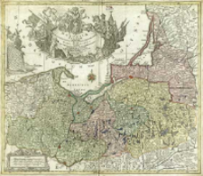
Title: Borussiæ Regnum complectens Circulos Sambiensem, Natangienensem et Hockerlandiæ Nec non Borussia Polonica exhibens Palatinatus Culmiensem, Marienburgensem, Pomerelliæ et Varmiæ Cum adjacentibus aliis Provinciis
Subtitle:
Contributor:
Lotter, Tobias Conrad (1717–1777) : Wyd.
Publisher:
Sumtibus [!] et Curis exarata Tobiæ Conradi Lotteri Geogr.
Place of publishing:
Description:
Scale [ca 1:730 000] ; 1 map : copperplate engrawing, hand col. ; 50x58 cm ; Independent map and map attached to atlases for exemple in "Atlas Novus sive Tabulae Geographicae totius orbis faciem [...]", [Augustae Vindelicorum, ca 1780] ; Prime meridian Ferro ; Cited in: Polska na mapach wydawców norymberskich i augsburskich z XVIII wieku / Bogusław Krassowski. - Warszawa, 1985, [id.] 138, p.128
Detailed Resource Type:
Format:
Resource Identifier:
Source:
CBGiOŚ. IGiPZ PAN, call no. PTG D.1093 [I.7A-3] ; click here to follow the link
Language:
Rights:
Terms of use:
Digitizing institution:
Institute of Geography and Spatial Organization of the Polish Academy of Sciences
Original in:
Projects co-financed by:
Programme Innovative Economy, 2010-2014, Priority Axis 2. R&D infrastructure ; European Union. European Regional Development Fund
Access:
Object collections:
- Digital Repository of Scientific Institutes > Partners' collections > Institute of Geography and Spatial Organization PAS (IGiPZ PAN) > Library
- Digital Repository of Scientific Institutes > Partners' collections > Institute of Geography and Spatial Organization PAS (IGiPZ PAN) > Library > Maps and atlases
- Digital Repository of Scientific Institutes > Partners' collections > Institute of Geography and Spatial Organization PAS (IGiPZ PAN) > Library > Selected collections > Polish Geographical Society Collection
- Digital Repository of Scientific Institutes > Literature > Maps/Atlases
Last modified:
Oct 2, 2020
In our library since:
Jul 11, 2014
Number of object content downloads / hits:
237
All available object's versions:
https://rcin.org.pl./publication/52546
Show description in RDF format:
Show description in RDFa format:
Show description in OAI-PMH format:
Objects Similar
Sotzmann, Daniel Fridrich (1754–1840)
Homann, Johann Baptist (1664–1724)
Homann, Johann Baptist (1664–1724)
Pfau, Theodor Philipp (1725–1794) Glassbach, Christian Benjamin (1724–1779)
Seutter, Matthäus (1678 – c. 1757)
Homann, Johann Baptist (1664–1724)

 INSTYTUT ARCHEOLOGII I ETNOLOGII POLSKIEJ AKADEMII NAUK
 INSTYTUT BADAŃ LITERACKICH POLSKIEJ AKADEMII NAUK
 INSTYTUT BADAWCZY LEŚNICTWA
 INSTYTUT BIOLOGII DOŚWIADCZALNEJ IM. MARCELEGO NENCKIEGO POLSKIEJ AKADEMII NAUK
 INSTYTUT BIOLOGII SSAKÓW POLSKIEJ AKADEMII NAUK
 INSTYTUT CHEMII FIZYCZNEJ PAN
 INSTYTUT CHEMII ORGANICZNEJ PAN
 INSTYTUT FILOZOFII I SOCJOLOGII PAN
 INSTYTUT GEOGRAFII I PRZESTRZENNEGO ZAGOSPODAROWANIA PAN
 INSTYTUT HISTORII im. TADEUSZA MANTEUFFLA POLSKIEJ AKADEMII NAUK
 INSTYTUT JĘZYKA POLSKIEGO POLSKIEJ AKADEMII NAUK
 INSTYTUT MATEMATYCZNY PAN
 INSTYTUT MEDYCYNY DOŚWIADCZALNEJ I KLINICZNEJ IM.MIROSŁAWA MOSSAKOWSKIEGO POLSKIEJ AKADEMII NAUK
 INSTYTUT PODSTAWOWYCH PROBLEMÓW TECHNIKI PAN
 INSTYTUT SLAWISTYKI PAN
 SIEĆ BADAWCZA ŁUKASIEWICZ - INSTYTUT TECHNOLOGII MATERIAŁÓW ELEKTRONICZNYCH
 MUZEUM I INSTYTUT ZOOLOGII POLSKIEJ AKADEMII NAUK
 INSTYTUT BADAŃ SYSTEMOWYCH PAN
 INSTYTUT BOTANIKI IM. WŁADYSŁAWA SZAFERA POLSKIEJ AKADEMII NAUK


