- About project
- Collections
- Indexes
- Recently viewed
-
RCIN Repositories
-
 INSTYTUT ARCHEOLOGII I ETNOLOGII POLSKIEJ AKADEMII NAUK
-
 INSTYTUT BADAŃ LITERACKICH POLSKIEJ AKADEMII NAUK
-
 INSTYTUT BADAWCZY LEŚNICTWA
-
 INSTYTUT BIOLOGII DOŚWIADCZALNEJ IM. MARCELEGO NENCKIEGO POLSKIEJ AKADEMII NAUK
-
 INSTYTUT BIOLOGII SSAKÓW POLSKIEJ AKADEMII NAUK
-
 INSTYTUT CHEMII FIZYCZNEJ PAN
-
 INSTYTUT CHEMII ORGANICZNEJ PAN
-
 INSTYTUT FILOZOFII I SOCJOLOGII PAN
-
 INSTYTUT GEOGRAFII I PRZESTRZENNEGO ZAGOSPODAROWANIA PAN
-
 INSTYTUT HISTORII im. TADEUSZA MANTEUFFLA POLSKIEJ AKADEMII NAUK
-
 INSTYTUT JĘZYKA POLSKIEGO POLSKIEJ AKADEMII NAUK
-
 INSTYTUT MATEMATYCZNY PAN
-
 INSTYTUT MEDYCYNY DOŚWIADCZALNEJ I KLINICZNEJ IM.MIROSŁAWA MOSSAKOWSKIEGO POLSKIEJ AKADEMII NAUK
-
 INSTYTUT PODSTAWOWYCH PROBLEMÓW TECHNIKI PAN
-
 INSTYTUT SLAWISTYKI PAN
-
 SIEĆ BADAWCZA ŁUKASIEWICZ - INSTYTUT TECHNOLOGII MATERIAŁÓW ELEKTRONICZNYCH
-
 MUZEUM I INSTYTUT ZOOLOGII POLSKIEJ AKADEMII NAUK
-
 INSTYTUT BADAŃ SYSTEMOWYCH PAN
-
 INSTYTUT BOTANIKI IM. WŁADYSŁAWA SZAFERA POLSKIEJ AKADEMII NAUK
-
- Search in all Repository
- Literature and maps
- Archeology
- Mills database
- Natural sciences
Advanced search
Advanced search
Advanced search
Advanced search
Advanced search

Object
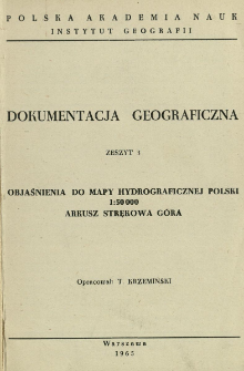
Title: Objaśnienia do mapy hydrograficznej Polski 1:50 000 : arkusz Strękowa Góra
Subtitle:
Dokumentacja Geograficzna 1965 z. 3
Contributor:
Krzemiński, Tadeusz (1925– ) : Oprac.
Publisher:
Place of publishing:
Description:
36, [1] p., 8 k. tabl. : il. ; 20 cm ; Bibliogr. pp. 32-34
Type of object:
Relation:
Detailed Resource Type:
Format:
File size 4,8 MB ; application/pdf
Resource Identifier:
Source:
CBGiOŚ. IGiPZ PAN, call no. Cz.944[1965, z.3] ; CBGiOŚ. IGiPZ PAN, call no. Cz.5709[1965, z.3] ; CBGiOŚ. IGiPZ PAN, call no. Cz.5711[1965, z.3] ; click here to follow the link
Language:
Rights:
Terms of use:
Copyright-protected material. May be used within the limits of statutory user freedoms
Digitizing institution:
Institute of Geography and Spatial Organization of the Polish Academy of Sciences
Original in:
Projects co-financed by:
Programme Innovative Economy, 2010-2014, Priority Axis 2. R&D infrastructure ; European Union. European Regional Development Fund
Access:
Object collections:
- Digital Repository of Scientific Institutes > Partners' collections > Institute of Geography and Spatial Organization PAS (IGiPZ PAN) > Publications of IGiPZ PAN and employees
- Digital Repository of Scientific Institutes > Partners' collections > Institute of Geography and Spatial Organization PAS (IGiPZ PAN) > Library > Books
- Digital Repository of Scientific Institutes > Partners' collections > Institute of Geography and Spatial Organization PAS (IGiPZ PAN) > Library > Series/Journals/Periodics
- Digital Repository of Scientific Institutes > Literature > Books/Chapters
Last modified:
Oct 2, 2020
In our library since:
Feb 25, 2014
Number of object content downloads / hits:
968
All available object's versions:
https://rcin.org.pl./publication/50340
Show description in RDF format:
Show description in RDFa format:
Show description in OAI-PMH format:
| Edition name | Date |
|---|---|
| z. 3 (1965) : Objaśnienia do mapy hydrograficznej Polski 1:50 000 : arkusz Strękowa Góra | Oct 2, 2020 |
Objects Similar
Wit-Jóźwik, Krystyna ( –2003)
Dokumentacja Geograficzna 1960 z. 5
Wit-Jóźwik, Krystyna ( –2003) Ziemońska, Zofia


