- Search in all Repository
- Literature and maps
- Archeology
- Mills database
- Natural sciences
Advanced search
Advanced search
Advanced search
Advanced search
Advanced search

Object
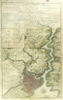
Title: Bosphorvs Thracicvs. Der Kanal des Schwarzen Meers oder die Meer-Enge bey Constantinopel sambt denen an beiden Ufern desselben gelegenen Stätten, Flecken, Dörffern, Schlössern, Palasten, Lusthäusern, Waserleitungen
Subtitle:
Contributor:
Publisher:
herausgegeben durch Homann[ische] Erben
Place of publishing:
Description:
Skala [ca 1:40 000], podziałka liniowa: Eine Stunde Weges ; 1 mapa : miedzior. kolor. ; 81x51 cm ; Orientacja mapy północno-wschodnia ; W ramkach w górnej i lewej części mapy literowy i alfabetyczny spis ważniejszych obiektów oznaczonych na mapie z objaśnieniem: "Erklärung der Buchschtaben u. Zahlen ; Wektorami oznaczono na mapie miejsca z których dokonano pomiarów terenu ; Tyt. w jęz. łac., podtyt. i opisy w jęz. niem., niektóre w jęz. tur., nazwy mórz w trzech jęz.
Detailed Resource Type:
Format:
Rozmiar pliku 9,8 MB ; image/x.djvu
Resource Identifier:
Source:
CBGiOŚ. IGiPZ PAN, sygn. Ds.8266 [T.10/9] ; CBGiOŚ. IGiPZ PAN, sygn. Ds.8915 [T.10/8] ; click here to follow the link
Language:
Rights:
Terms of use:
Digitizing institution:
Instytut Geografii i Przestrzennego Zagospodarowania Polskiej Akademii Nauk
Original in:
Projects co-financed by:
Program Operacyjny Innowacyjna Gospodarka, lata 2010-2014, Priorytet 2. Infrastruktura strefy B + R ; Unia Europejska. Europejski Fundusz Rozwoju Regionalnego
Access:
Object collections:
- Digital Repository of Scientific Institutes > Partners' collections > Institute of Geography and Spatial Organization PAS (IGiPZ PAN) > Library
- Digital Repository of Scientific Institutes > Partners' collections > Institute of Geography and Spatial Organization PAS (IGiPZ PAN) > Library > Maps and atlases
- Digital Repository of Scientific Institutes > Literature > Maps/Atlases
Last modified:
Oct 2, 2020
In our library since:
Sep 29, 2016
Number of object content downloads / hits:
83
All available object's versions:
https://rcin.org.pl./publication/48344
Show description in RDF format:
Show description in RDFa format:
Show description in OAI-PMH format:
Objects Similar
Visscher, Nicolaes Jansz (1649–1702)
Sotzmann, Daniel Fridrich (1754–1840) Glassbach, Carl Christian (1751-post 1791)
Delisle, Guillaume (1675–1726)

 INSTYTUT ARCHEOLOGII I ETNOLOGII POLSKIEJ AKADEMII NAUK
 INSTYTUT BADAŃ LITERACKICH POLSKIEJ AKADEMII NAUK
 INSTYTUT BADAWCZY LEŚNICTWA
 INSTYTUT BIOLOGII DOŚWIADCZALNEJ IM. MARCELEGO NENCKIEGO POLSKIEJ AKADEMII NAUK
 INSTYTUT BIOLOGII SSAKÓW POLSKIEJ AKADEMII NAUK
 INSTYTUT CHEMII FIZYCZNEJ PAN
 INSTYTUT CHEMII ORGANICZNEJ PAN
 INSTYTUT FILOZOFII I SOCJOLOGII PAN
 INSTYTUT GEOGRAFII I PRZESTRZENNEGO ZAGOSPODAROWANIA PAN
 INSTYTUT HISTORII im. TADEUSZA MANTEUFFLA POLSKIEJ AKADEMII NAUK
 INSTYTUT JĘZYKA POLSKIEGO POLSKIEJ AKADEMII NAUK
 INSTYTUT MATEMATYCZNY PAN
 INSTYTUT MEDYCYNY DOŚWIADCZALNEJ I KLINICZNEJ IM.MIROSŁAWA MOSSAKOWSKIEGO POLSKIEJ AKADEMII NAUK
 INSTYTUT PODSTAWOWYCH PROBLEMÓW TECHNIKI PAN
 INSTYTUT SLAWISTYKI PAN
 SIEĆ BADAWCZA ŁUKASIEWICZ - INSTYTUT TECHNOLOGII MATERIAŁÓW ELEKTRONICZNYCH
 MUZEUM I INSTYTUT ZOOLOGII POLSKIEJ AKADEMII NAUK
 INSTYTUT BADAŃ SYSTEMOWYCH PAN
 INSTYTUT BOTANIKI IM. WŁADYSŁAWA SZAFERA POLSKIEJ AKADEMII NAUK


