- Search in all Repository
- Literature and maps
- Archeology
- Mills database
- Natural sciences
Advanced search
Advanced search
Advanced search
Advanced search
Advanced search

Object
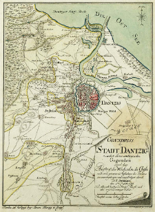
Title: Grundriss der Stadt Dantzig nebst ihren umliegenden Gegenden und dem Ausfluss der Weichsel in die Ostsee
Creator:
Sotzmann, Daniel Fridrich (1754–1840) : Oprac. ; Glassbach, Carl Christian (1751-post 1791) : Ryt.
Date issued/created:
Resource type:
Publisher:
im Verlage bey Simon Schropp et Comp
Place of publishing:
Description:
Scale [ca 1:96 000] ; 1 map : copperplate engraving, hand col. ; 24x18 cm ; Nach einer genauen Aufnahme des Terrains zusammengetragen und angefertiget durch D. F. Sotzmann den 1ten Novbr. 1783; C. C. Glassbach sen. sc. Berol ; Cited in: Historische Pläne und Grundrisse von Städten und Ortschaften in Polen, poz. 663
Detailed Resource Type:
Format:
File size 0,7 MB ; image/x.djvu
Resource Identifier:
Source:
CBGiOŚ. IGiPZ PAN, call no. Ds.7952 [IX.11B-12] ; click here to follow the link
Language:
Rights:
Terms of use:
Digitizing institution:
Institute of Geography and Spatial Organization of the Polish Academy of Sciences
Original in:
Projects co-financed by:
Programme Innovative Economy, 2010-2014, Priority Axis 2. R&D infrastructure ; European Union. European Regional Development Fund
Access:
Object collections:
- Digital Repository of Scientific Institutes > Partners' collections > Institute of Geography and Spatial Organization PAS (IGiPZ PAN) > Library > Maps and atlases
- Digital Repository of Scientific Institutes > Literature > Maps/Atlases
Last modified:
Oct 2, 2020
In our library since:
Sep 9, 2011
Number of object content downloads / hits:
329
All available object's versions:
https://rcin.org.pl./publication/2724
Show description in RDF format:
Show description in RDFa format:
Show description in OAI-PMH format:
Objects Similar
Sotzmann, Daniel Fridrich (1754–1840) Penningh, Harry John Glassbach, Carl Christian (1751-post 1791) Schmidt, Friedrich August Sander, Wilhelm (c. 1766 – 1836)
Sotzmann, Daniel Fridrich (1754–1840)
Sotzmann, Daniel Fridrich (1754–1840)
Sotzmann, Daniel Fridrich (1754–1840)
Sotzmann, Daniel Fridrich (1754–1840) Gürsch, Carl Friedrich
Gilly, David (1748–1808) Sotzmann, Daniel Fridrich (1754–1840)
Sotzmann, Daniel Fridrich (1754–1840) Gürsch, Carl Friedrich

 INSTYTUT ARCHEOLOGII I ETNOLOGII POLSKIEJ AKADEMII NAUK
 INSTYTUT BADAŃ LITERACKICH POLSKIEJ AKADEMII NAUK
 INSTYTUT BADAWCZY LEŚNICTWA
 INSTYTUT BIOLOGII DOŚWIADCZALNEJ IM. MARCELEGO NENCKIEGO POLSKIEJ AKADEMII NAUK
 INSTYTUT BIOLOGII SSAKÓW POLSKIEJ AKADEMII NAUK
 INSTYTUT CHEMII FIZYCZNEJ PAN
 INSTYTUT CHEMII ORGANICZNEJ PAN
 INSTYTUT FILOZOFII I SOCJOLOGII PAN
 INSTYTUT GEOGRAFII I PRZESTRZENNEGO ZAGOSPODAROWANIA PAN
 INSTYTUT HISTORII im. TADEUSZA MANTEUFFLA POLSKIEJ AKADEMII NAUK
 INSTYTUT JĘZYKA POLSKIEGO POLSKIEJ AKADEMII NAUK
 INSTYTUT MATEMATYCZNY PAN
 INSTYTUT MEDYCYNY DOŚWIADCZALNEJ I KLINICZNEJ IM.MIROSŁAWA MOSSAKOWSKIEGO POLSKIEJ AKADEMII NAUK
 INSTYTUT PODSTAWOWYCH PROBLEMÓW TECHNIKI PAN
 INSTYTUT SLAWISTYKI PAN
 SIEĆ BADAWCZA ŁUKASIEWICZ - INSTYTUT TECHNOLOGII MATERIAŁÓW ELEKTRONICZNYCH
 MUZEUM I INSTYTUT ZOOLOGII POLSKIEJ AKADEMII NAUK
 INSTYTUT BADAŃ SYSTEMOWYCH PAN
 INSTYTUT BOTANIKI IM. WŁADYSŁAWA SZAFERA POLSKIEJ AKADEMII NAUK


