- Search in all Repository
- Literature and maps
- Archeology
- Mills database
- Natural sciences
Advanced search
Advanced search
Advanced search
Advanced search
Advanced search

Object
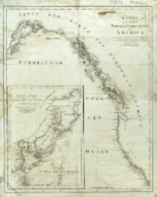
Title: Karte von einem Theil der Nordwestlichen Küste von America : zu der Reise des Capit George Vancouver in den Jahren 1792, 1793 ung 1794
Contributor:
Publisher:
Place of publishing:
Description:
Skala [ca 1:6 500 000] ; 1 mapa : miedzior. ; 51x41cm ; Południk zerowy Greenwich; na mapie pobocznej południk Paris ; Mapa poboczna: General Karte der Entdeckungen, die im Jahre 1787 in den Chinesischen und Tartarischen Meeren, oder von Manilla bis Awatscha hin, von den Franzsïschen Fregatten la Boussole u. l'Astrolabe gemacht worden sind zur Reisebeschreibung des la Perouse, im Jahre 1800, verjun̈gt gezeichnet von D.F. Sotzmann
Detailed Resource Type:
Format:
File size 2,1 MB ; image/x.djvu
Resource Identifier:
Source:
CBGiOŚ. IGiPZ PAN, call no. D.1647 ; click here to follow the link
Language:
Rights:
Terms of use:
Digitizing institution:
Institute of Geography and Spatial Organization of the Polish Academy of Sciences
Original in:
Projects co-financed by:
Programme Innovative Economy, 2010-2014, Priority Axis 2. R&D infrastructure ; European Union. European Regional Development Fund
Access:
Object collections:
- Digital Repository of Scientific Institutes > Partners' collections > Institute of Geography and Spatial Organization PAS (IGiPZ PAN) > Library
- Digital Repository of Scientific Institutes > Partners' collections > Institute of Geography and Spatial Organization PAS (IGiPZ PAN) > Library > Maps and atlases
- Digital Repository of Scientific Institutes > Literature > Maps/Atlases
Last modified:
Oct 2, 2020
In our library since:
Jul 22, 2016
Number of object content downloads / hits:
58
All available object's versions:
https://rcin.org.pl./publication/56336
Show description in RDF format:
Show description in RDFa format:
Show description in OAI-PMH format:
Objects Similar
Sotzmann, Daniel Fridrich (1754–1840)
Sotzmann, Daniel Fridrich (1754–1840)
Sotzmann, Daniel Fridrich (1754–1840) Gürsch, Carl Friedrich
Sotzmann, Daniel Fridrich (1754–1840) Gürsch, Carl Friedrich
Sotzmann, Daniel Fridrich (1754–1840) Berger, Daniel (1744–1824) Jäck, Carl (1763–1808)
Sotzmann, Daniel Fridrich (1754–1840) Penningh, Harry John Glassbach, Carl Christian (1751-post 1791) Schmidt, Friedrich August Sander, Wilhelm (c. 1766 – 1836)
Gilly, David (1748–1808) Sotzmann, Daniel Fridrich (1754–1840)

 INSTYTUT ARCHEOLOGII I ETNOLOGII POLSKIEJ AKADEMII NAUK
 INSTYTUT BADAŃ LITERACKICH POLSKIEJ AKADEMII NAUK
 INSTYTUT BADAWCZY LEŚNICTWA
 INSTYTUT BIOLOGII DOŚWIADCZALNEJ IM. MARCELEGO NENCKIEGO POLSKIEJ AKADEMII NAUK
 INSTYTUT BIOLOGII SSAKÓW POLSKIEJ AKADEMII NAUK
 INSTYTUT CHEMII FIZYCZNEJ PAN
 INSTYTUT CHEMII ORGANICZNEJ PAN
 INSTYTUT FILOZOFII I SOCJOLOGII PAN
 INSTYTUT GEOGRAFII I PRZESTRZENNEGO ZAGOSPODAROWANIA PAN
 INSTYTUT HISTORII im. TADEUSZA MANTEUFFLA POLSKIEJ AKADEMII NAUK
 INSTYTUT JĘZYKA POLSKIEGO POLSKIEJ AKADEMII NAUK
 INSTYTUT MATEMATYCZNY PAN
 INSTYTUT MEDYCYNY DOŚWIADCZALNEJ I KLINICZNEJ IM.MIROSŁAWA MOSSAKOWSKIEGO POLSKIEJ AKADEMII NAUK
 INSTYTUT PODSTAWOWYCH PROBLEMÓW TECHNIKI PAN
 INSTYTUT SLAWISTYKI PAN
 SIEĆ BADAWCZA ŁUKASIEWICZ - INSTYTUT TECHNOLOGII MATERIAŁÓW ELEKTRONICZNYCH
 MUZEUM I INSTYTUT ZOOLOGII POLSKIEJ AKADEMII NAUK
 INSTYTUT BADAŃ SYSTEMOWYCH PAN
 INSTYTUT BOTANIKI IM. WŁADYSŁAWA SZAFERA POLSKIEJ AKADEMII NAUK


