- O repozytorium
- Kolekcje
- Indeksy
- Historia przeglądania
-
Repozytoria RCIN
-
 INSTYTUT ARCHEOLOGII I ETNOLOGII POLSKIEJ AKADEMII NAUK
-
 INSTYTUT BADAŃ LITERACKICH POLSKIEJ AKADEMII NAUK
-
 INSTYTUT BADAWCZY LEŚNICTWA
-
 INSTYTUT BIOLOGII DOŚWIADCZALNEJ IM. MARCELEGO NENCKIEGO POLSKIEJ AKADEMII NAUK
-
 INSTYTUT BIOLOGII SSAKÓW POLSKIEJ AKADEMII NAUK
-
 INSTYTUT CHEMII FIZYCZNEJ PAN
-
 INSTYTUT CHEMII ORGANICZNEJ PAN
-
 INSTYTUT FILOZOFII I SOCJOLOGII PAN
-
 INSTYTUT GEOGRAFII I PRZESTRZENNEGO ZAGOSPODAROWANIA PAN
-
 INSTYTUT HISTORII im. TADEUSZA MANTEUFFLA POLSKIEJ AKADEMII NAUK
-
 INSTYTUT JĘZYKA POLSKIEGO POLSKIEJ AKADEMII NAUK
-
 INSTYTUT MATEMATYCZNY PAN
-
 INSTYTUT MEDYCYNY DOŚWIADCZALNEJ I KLINICZNEJ IM.MIROSŁAWA MOSSAKOWSKIEGO POLSKIEJ AKADEMII NAUK
-
 INSTYTUT PODSTAWOWYCH PROBLEMÓW TECHNIKI PAN
-
 INSTYTUT SLAWISTYKI PAN
-
 SIEĆ BADAWCZA ŁUKASIEWICZ - INSTYTUT TECHNOLOGII MATERIAŁÓW ELEKTRONICZNYCH
-
 MUZEUM I INSTYTUT ZOOLOGII POLSKIEJ AKADEMII NAUK
-
 INSTYTUT BADAŃ SYSTEMOWYCH PAN
-
 INSTYTUT BOTANIKI IM. WŁADYSŁAWA SZAFERA POLSKIEJ AKADEMII NAUK
-

Obiekt
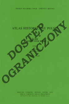
Tytuł: Śląsk w końcu XVIII wieku ; 2, cz. 1, Mapy
Inny tytuł:
Atlas historyczny Polski - Polska Akademia Nauk. Instytut Historii. Mapy XVIII wieku ; 2, cz, 1
Współtwórca:
Janczak, Julian (1932–1995) : Red. ; Institute of History of the Polish Academy of Sciences
Wydawca:
Zakład Narodowy im. Ossolińskich - Wydawnictwo Polskiej Akademii Nauk
Miejsce wydania:
Opis:
Description from the cover ; complements the text published in the Atlas historyczny Polski. Polska Akademia Nauk. Instytut Historii. Mapy XVIII wieku ; 2 ; contens maps: craft, industry and trade in Silesia in the 18th c. ; Silesia at the end of the 18th c. ; Wrocław at the end of the 18th c. ; Scales differ ; 6 maps col. jointly folded in cover 30x20 cm ; List of maps pol., rus., fre., ger.
Typ obiektu:
Czasopismo/Seria/cykl:
Atlas historyczny Polski - Polska Akademia Nauk. Instytut Historii. Mapy XVIII wieku ; 2, cz. 1
Szczegółowy typ zasobu:
Format:
Identyfikator zasobu:
Źródło:
IH PAN, sygn. III.847/2, cz.1 Podr. ; IH PAN, sygn. III.848/2, cz.1 ; kliknij tutaj, żeby przejść
Język:
Prawa:
Rights Reserved - Restricted Access
Zasady wykorzystania:
Digitalizacja:
Institute of History of the Polish Academy of Sciences
Lokalizacja oryginału:
Library of the Institute of History PAS
Dofinansowane ze środków:
Programme Innovative Economy, 2010-2014, Priority Axis 2. R&D infrastructure ; European Union. European Regional Development Fund
Dostęp:
Kolekcje, do których przypisany jest obiekt:
- Repozytorium Cyfrowe Instytutów Naukowych > Kolekcje Partnerów > Instytut Historii PAN > Atlasy historyczne
- Repozytorium Cyfrowe Instytutów Naukowych > Kolekcje Partnerów > Instytut Historii PAN > Wydawnictwa Instytutu
- Repozytorium Cyfrowe Instytutów Naukowych > Kolekcje Partnerów > Instytut Historii PAN > Wydawnictwa Instytutu > Książki
- Repozytorium Cyfrowe Instytutów Naukowych > Piśmiennictwo > Mapy/Atlasy
Data ostatniej modyfikacji:
2 paź 2020
Data dodania obiektu:
30 maj 2012
Liczba pobrań / odtworzeń:
210
Wszystkie dostępne wersje tego obiektu:
https://rcin.org.pl./publication/17442
Wyświetl opis w formacie RDF:
Wyświetl opis w formacie RDFa:
Wyświetl opis w formacie OAI-PMH:
| Nazwa wydania | Data |
|---|---|
| Śląsk w końcu XVIII wieku ; 2, cz. 1, Mapy | 2 paź 2020 |
Obiekty Podobne
Seutter, Matthäus (1678 – c. 1757)
Putzger, Friedrich Wilhelm (1849–1913) Baldamus, Alfred (1856–1908) Schwabe, Ernst (1858–1927)
Putzger, Friedrich Wilhelm (1849–1913) Pehle, Max (1881–1939) Silberborth, Hans (1887–1949) Iskraut, Martin
Niewiadomski, Eligiusz (1869–1923) Zakłady Wydawnicze "M. Arct".
Bazewicz, Józef Michał (c. 1862 – 1928)
Bazewicz, Józef Michał (c. 1862 – 1928)


