- Search in all Repository
- Literature and maps
- Archeology
- Mills database
- Natural sciences
Advanced search
Advanced search
Advanced search
Advanced search
Advanced search

Object
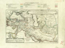
Title: Typvs Ætiologicvs II. Sistens uno obtutu Ductum totius itineris Xenophontæi, et Stathmorum Parthicorum Isidori Characeni, juncta descriptione Ponti Evxini juxta Arrianum, litoris Persici et Peripli Nearchi juxta eundem Arrianum et Marcianum Heracleotam, una cum distantiis quibusdam Asiæ profundæ juxta Alexandri mensores et Plinium.
Subtitle:
Contributor:
Publisher:
Place of publishing:
Description:
Skala [ca 1:9 800 000] ; 1 mapa : miedzior, kolor. ręcznie. ; 26x42 cm, na ark. 41x55 cm ; Rzeźba terenu przedst. metodą kopczykową ; Poludnik zerowy Ferro ; Data wyd. wg. BVB online
Detailed Resource Type:
Format:
Resource Identifier:
Source:
CBGiOŚ. IGiPZ PAN, call no. Ds.8530 ; click here to follow the link
Language:
Rights:
Terms of use:
Digitizing institution:
Institute of Geography and Spatial Organization of the Polish Academy of Sciences
Original in:
Projects co-financed by:
Programme Innovative Economy, 2010-2014, Priority Axis 2. R&D infrastructure ; European Union. European Regional Development Fund
Access:
Object collections:
- Digital Repository of Scientific Institutes > Partners' collections > Institute of Geography and Spatial Organization PAS (IGiPZ PAN) > Library
- Digital Repository of Scientific Institutes > Partners' collections > Institute of Geography and Spatial Organization PAS (IGiPZ PAN) > Library > Maps and atlases
- Digital Repository of Scientific Institutes > Literature > Maps/Atlases
Last modified:
Oct 2, 2020
In our library since:
May 14, 2013
Number of object content downloads / hits:
39
All available object's versions:
https://rcin.org.pl./publication/41299
Show description in RDF format:
Show description in RDFa format:
Show description in OAI-PMH format:
Objects Similar
Schreiber, Johann Georg (1676–1750)
Anville, Jean Baptiste Burguignon d' (1697–1782)
Schreiber, Johann Georg (1676–1750)
Delisle, Guillaume (1675–1726)
Blankaart, Nicolaus (1624–1703)
Faden, William (1749–1836)
Anville, Jean Baptiste Burguignon d' (1697–1782)

 INSTYTUT ARCHEOLOGII I ETNOLOGII POLSKIEJ AKADEMII NAUK
 INSTYTUT BADAŃ LITERACKICH POLSKIEJ AKADEMII NAUK
 INSTYTUT BADAWCZY LEŚNICTWA
 INSTYTUT BIOLOGII DOŚWIADCZALNEJ IM. MARCELEGO NENCKIEGO POLSKIEJ AKADEMII NAUK
 INSTYTUT BIOLOGII SSAKÓW POLSKIEJ AKADEMII NAUK
 INSTYTUT CHEMII FIZYCZNEJ PAN
 INSTYTUT CHEMII ORGANICZNEJ PAN
 INSTYTUT FILOZOFII I SOCJOLOGII PAN
 INSTYTUT GEOGRAFII I PRZESTRZENNEGO ZAGOSPODAROWANIA PAN
 INSTYTUT HISTORII im. TADEUSZA MANTEUFFLA POLSKIEJ AKADEMII NAUK
 INSTYTUT JĘZYKA POLSKIEGO POLSKIEJ AKADEMII NAUK
 INSTYTUT MATEMATYCZNY PAN
 INSTYTUT MEDYCYNY DOŚWIADCZALNEJ I KLINICZNEJ IM.MIROSŁAWA MOSSAKOWSKIEGO POLSKIEJ AKADEMII NAUK
 INSTYTUT PODSTAWOWYCH PROBLEMÓW TECHNIKI PAN
 INSTYTUT SLAWISTYKI PAN
 SIEĆ BADAWCZA ŁUKASIEWICZ - INSTYTUT TECHNOLOGII MATERIAŁÓW ELEKTRONICZNYCH
 MUZEUM I INSTYTUT ZOOLOGII POLSKIEJ AKADEMII NAUK
 INSTYTUT BADAŃ SYSTEMOWYCH PAN
 INSTYTUT BOTANIKI IM. WŁADYSŁAWA SZAFERA POLSKIEJ AKADEMII NAUK


