- Search in all Repository
- Literature and maps
- Archeology
- Mills database
- Natural sciences
Advanced search
Advanced search
Advanced search
Advanced search
Advanced search

Object
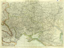
Title: Karte der Ukraina
Subtitle:
Publisher:
Kartographische Anstalt Freytag-Berndt u. Artaria, K.G.
Place of publishing:
Description:
Scale 1:2 000 000 ; 1 map : col. ; 72x102 cm, on sheet 80x110 cm ; Date on the map: V.1941
Relation:
Detailed Resource Type:
Format:
Resource Identifier:
Source:
CBGiOŚ. IGiPZ PAN, call no. D.6513 [m.polit.-adm.-inne tereny 12] ; click here to follow the link
Language:
Rights:
Terms of use:
Digitizing institution:
Institute of Geography and Spatial Organization of the Polish Academy of Sciences
Original in:
Projects co-financed by:
Programme Innovative Economy, 2010-2014, Priority Axis 2. R&D infrastructure ; European Union. European Regional Development Fund
Access:
Object collections:
- Digital Repository of Scientific Institutes > Partners' collections > Institute of Geography and Spatial Organization PAS (IGiPZ PAN) > Library
- Digital Repository of Scientific Institutes > Partners' collections > Institute of Geography and Spatial Organization PAS (IGiPZ PAN) > Library > Maps and atlases
- Digital Repository of Scientific Institutes > Literature > Maps/Atlases
Last modified:
Oct 2, 2020
In our library since:
Jun 4, 2013
Number of object content downloads / hits:
223
All available object's versions:
https://rcin.org.pl./publication/38504
Show description in RDF format:
Show description in RDFa format:
Show description in OAI-PMH format:
| Edition name | Date |
|---|---|
| Karte der Ukraina, 1941 | Oct 2, 2020 |
Objects Similar
Rosja. Armiâ. Glavnyj štab. Litografìâ kartografičeskago zavedenìâ. Wydawca Rosja. Armiâ. Glavnyj štab. Voenno-topografičeskij otdel. Instytucja sprawcza
Rosja. Armiâ. Glavnyj štab. Voenno-topografičeskij otdel. Instytucja sprawcza Związek Radziecki. Vserossijskij Glavnyj Štab. Litografiâ kartografičeskogo otdela. Wydawca
Rosja. Armiâ. Glavnyj štab. Voenno-topografičeskij otdel. Instytucja sprawcza
Rosja. Armiâ. Glavnyj štab. Voenno-topografičeskij otdel. Instytucja sprawcza
Rosja. Armiâ. Glavnyj štab. Litografìâ kartografičeskago zavedenìâ. Wydawca Rosja. Armiâ. Glavnyj štab. Voenno-topografičeskij otdel. Instytucja sprawcza
Rosja. Armiâ. Glavnyj štab. Litografìâ kartografičeskago zavedenìâ. Wydawca Rosja. Armiâ. Glavnyj štab. Voenno-topografičeskij otdel. Instytucja sprawcza
Rosja. Armiâ. Glavnyj štab. Litografìâ kartografičeskago zavedenìâ. Wydawca Rosja. Armiâ. Glavnyj štab. Voenno-topografičeskij otdel. Instytucja sprawcza
Niemcy. Heer. Generalstab. Abteilung für Kriegskarten und Vermessungswesen. Wydawca

 INSTYTUT ARCHEOLOGII I ETNOLOGII POLSKIEJ AKADEMII NAUK
 INSTYTUT BADAŃ LITERACKICH POLSKIEJ AKADEMII NAUK
 INSTYTUT BADAWCZY LEŚNICTWA
 INSTYTUT BIOLOGII DOŚWIADCZALNEJ IM. MARCELEGO NENCKIEGO POLSKIEJ AKADEMII NAUK
 INSTYTUT BIOLOGII SSAKÓW POLSKIEJ AKADEMII NAUK
 INSTYTUT CHEMII FIZYCZNEJ PAN
 INSTYTUT CHEMII ORGANICZNEJ PAN
 INSTYTUT FILOZOFII I SOCJOLOGII PAN
 INSTYTUT GEOGRAFII I PRZESTRZENNEGO ZAGOSPODAROWANIA PAN
 INSTYTUT HISTORII im. TADEUSZA MANTEUFFLA POLSKIEJ AKADEMII NAUK
 INSTYTUT JĘZYKA POLSKIEGO POLSKIEJ AKADEMII NAUK
 INSTYTUT MATEMATYCZNY PAN
 INSTYTUT MEDYCYNY DOŚWIADCZALNEJ I KLINICZNEJ IM.MIROSŁAWA MOSSAKOWSKIEGO POLSKIEJ AKADEMII NAUK
 INSTYTUT PODSTAWOWYCH PROBLEMÓW TECHNIKI PAN
 INSTYTUT SLAWISTYKI PAN
 SIEĆ BADAWCZA ŁUKASIEWICZ - INSTYTUT TECHNOLOGII MATERIAŁÓW ELEKTRONICZNYCH
 MUZEUM I INSTYTUT ZOOLOGII POLSKIEJ AKADEMII NAUK
 INSTYTUT BADAŃ SYSTEMOWYCH PAN
 INSTYTUT BOTANIKI IM. WŁADYSŁAWA SZAFERA POLSKIEJ AKADEMII NAUK


