- Wyszukaj w całym Repozytorium
- Piśmiennictwo i mapy
- Archeologia
- Baza Młynów
- Nauki przyrodnicze
Wyszukiwanie zaawansowane
Wyszukiwanie zaawansowane
Wyszukiwanie zaawansowane
Wyszukiwanie zaawansowane
Wyszukiwanie zaawansowane

Obiekt
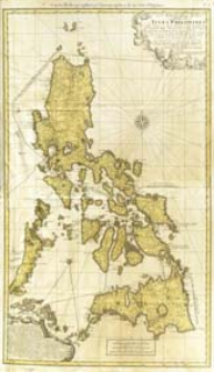
Tytuł: Carte Hydrographique & Chorographique des Isles Philippines
Subtitle:
Carta Hydrographica y. Chorographica a de las Ysles Filipinas
Contributor:
Murillo Velarde, Pedro (1696–1753) : Rys. ; Lowitz, Georg Moriz (1722–1774) : Oprac. ; Homannsche Erben
Publisher:
Publiée par les Heritiers de Homann
Place of publishing:
Description:
Skala [ca 1:2 000 000], podziałka Milliaria Germanica comunnia 15 in Gradu ; 1 mapa : miedzior., kolor. ręcznie ; 93x54 m ; Rzeźba terenu przedst. metodą kopczykową ; Na mapie 32-dwu rumbowa róża wiatrów ; Południk zerowy Ferro, ustalony po obliczeniach przez katalogującego ; W kartuszu: L'Original est gravé par Nicolas de la Cruz de Bagay, Indien de Tagalos, à Manille l'an 1734 ; W kartuszu: Dediée à Sa Majesté Catholique, par le Brigadier Don Ferdinand Valdes Tamon, Chevaliern de l'ordre de St. Jaques, Gouverneur & Capitaine Général des dites Isles ; W dolnym kartuszu opis przybycia Ferdynanda Magellana na Filipiny i ludności Filipin ; Miejsce wyd. wg wydawcy
Detailed Resource Type:
Format:
Resource Identifier:
Source:
CBGiOŚ. IGiPZ PAN, sygn. D.1650 ; kliknij tutaj, żeby przejść
Language:
Rights:
Terms of use:
Digitizing institution:
Instytut Geografii i Przestrzennego Zagospodarowania Polskiej Akademii Nauk
Original in:
Projects co-financed by:
Program Operacyjny Innowacyjna Gospodarka, lata 2010-2014, Priorytet 2. Infrastruktura strefy B + R ; Unia Europejska. Europejski Fundusz Rozwoju Regionalnego
Access:
Kolekcje, do których przypisany jest obiekt:
- Repozytorium Cyfrowe Instytutów Naukowych > Kolekcje Partnerów > Instytut Geografii i Przestrzennego Zagospodarowania PAN > Biblioteka Instytutu
- Repozytorium Cyfrowe Instytutów Naukowych > Kolekcje Partnerów > Instytut Geografii i Przestrzennego Zagospodarowania PAN > Biblioteka Instytutu > Mapy i atlasy
- Repozytorium Cyfrowe Instytutów Naukowych > Piśmiennictwo > Mapy/Atlasy
Data ostatniej modyfikacji:
Oct 2, 2020
Data dodania obiektu:
Mar 5, 2013
Liczba pobrań / odtworzeń:
59
Wszystkie dostępne wersje tego obiektu:
https://rcin.org.pl./publication/38219
Wyświetl opis w formacie RDF:
Wyświetl opis w formacie RDFa:
Wyświetl opis w formacie OAI-PMH:
| Nazwa wydania | Data |
|---|---|
| Carte Hydrographique & Chorographique des Isles Philippines, 1760 | Oct 2, 2020 |
Obiekty Podobne
La Borde, Jean-Benjamin de (1734–1794)

 INSTYTUT ARCHEOLOGII I ETNOLOGII POLSKIEJ AKADEMII NAUK
 INSTYTUT BADAŃ LITERACKICH POLSKIEJ AKADEMII NAUK
 INSTYTUT BADAWCZY LEŚNICTWA
 INSTYTUT BIOLOGII DOŚWIADCZALNEJ IM. MARCELEGO NENCKIEGO POLSKIEJ AKADEMII NAUK
 INSTYTUT BIOLOGII SSAKÓW POLSKIEJ AKADEMII NAUK
 INSTYTUT CHEMII FIZYCZNEJ PAN
 INSTYTUT CHEMII ORGANICZNEJ PAN
 INSTYTUT FILOZOFII I SOCJOLOGII PAN
 INSTYTUT GEOGRAFII I PRZESTRZENNEGO ZAGOSPODAROWANIA PAN
 INSTYTUT HISTORII im. TADEUSZA MANTEUFFLA POLSKIEJ AKADEMII NAUK
 INSTYTUT JĘZYKA POLSKIEGO POLSKIEJ AKADEMII NAUK
 INSTYTUT MATEMATYCZNY PAN
 INSTYTUT MEDYCYNY DOŚWIADCZALNEJ I KLINICZNEJ IM.MIROSŁAWA MOSSAKOWSKIEGO POLSKIEJ AKADEMII NAUK
 INSTYTUT PODSTAWOWYCH PROBLEMÓW TECHNIKI PAN
 INSTYTUT SLAWISTYKI PAN
 SIEĆ BADAWCZA ŁUKASIEWICZ - INSTYTUT TECHNOLOGII MATERIAŁÓW ELEKTRONICZNYCH
 MUZEUM I INSTYTUT ZOOLOGII POLSKIEJ AKADEMII NAUK
 INSTYTUT BADAŃ SYSTEMOWYCH PAN
 INSTYTUT BOTANIKI IM. WŁADYSŁAWA SZAFERA POLSKIEJ AKADEMII NAUK


