- Search in all Repository
- Literature and maps
- Archeology
- Mills database
- Natural sciences
Advanced search
Advanced search
Advanced search
Advanced search
Advanced search

Object
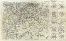
Title: G. Freytag & Berndt Autostrassenkarten. Blatt 21, Troppau (Opava) - Krakau (Kraków) = G. Freytag & Berndt cartes routières. Feuillet 21, Troppau (Opava) - Krakau (Kraków) = G. Freytag & Berndt auto road maps. Sheet 21, Troppau (Opava) - Krakau (Kraków)
Subtitle:
Troppau (Opava) - Krakau (Kraków) Blatt 21 ; G. Freytag & Berndt cartes routières ; G. Freytag & Berndt auto road maps ; Freytag et Berndt's Autostrassenkarten ; Freytag et Berndt's cartes routières pour automobilistes ; Freytag et Berndt's motoring maps
Contributor:
Kartographische Anstalt G. Freytag & Berndt
Publisher:
Kartogr. Anstalt G. Freytag & Berndt
Place of publishing:
Description:
Scale 1:300 000 ; 1 map : col. ; 54x65 cm, on sheet 62x94 cm, folded in cover 21x13 cm ; Map title ; On the map margin probably date of publication: IV.30 ; On the cover sheet index ; Ancillary maps: Gleiwitz [Gliwice], Beuten [Bytom], Krakau (Kraków), Ratibor [Racibórz], Kattowitz (W. Katowice), Königshütte (Huta Królewska) [Chorzów], Troppau (Opava), Mähr. Ostrau (Mor. Ostrava), Olmütz (Olomouc), Teschen (Č. Tĕšin) (P. Cieszyn) ; Legend of the map in English, French and German; geographical names in Polish
Relation:
G. Freytag & Berndt Autostrassenkarten
Detailed Resource Type:
Format:
Resource Identifier:
Source:
CBGiOŚ. IGiPZ PAN, call no. C.433[11] ; click here to follow the link
Language:
Rights:
Terms of use:
Digitizing institution:
Institute of Geography and Spatial Organization of the Polish Academy of Sciences
Original in:
Projects co-financed by:
Programme Innovative Economy, 2010-2014, Priority Axis 2. R&D infrastructure ; European Union. European Regional Development Fund
Access:
Object collections:
- Digital Repository of Scientific Institutes > Partners' collections > Institute of Geography and Spatial Organization PAS (IGiPZ PAN) > Library
- Digital Repository of Scientific Institutes > Partners' collections > Institute of Geography and Spatial Organization PAS (IGiPZ PAN) > Library > Maps and atlases
- Digital Repository of Scientific Institutes > Literature > Maps/Atlases
Last modified:
Oct 2, 2020
In our library since:
May 31, 2013
Number of object content downloads / hits:
368
All available object's versions:
https://rcin.org.pl./publication/33445

 INSTYTUT ARCHEOLOGII I ETNOLOGII POLSKIEJ AKADEMII NAUK
 INSTYTUT BADAŃ LITERACKICH POLSKIEJ AKADEMII NAUK
 INSTYTUT BADAWCZY LEŚNICTWA
 INSTYTUT BIOLOGII DOŚWIADCZALNEJ IM. MARCELEGO NENCKIEGO POLSKIEJ AKADEMII NAUK
 INSTYTUT BIOLOGII SSAKÓW POLSKIEJ AKADEMII NAUK
 INSTYTUT CHEMII FIZYCZNEJ PAN
 INSTYTUT CHEMII ORGANICZNEJ PAN
 INSTYTUT FILOZOFII I SOCJOLOGII PAN
 INSTYTUT GEOGRAFII I PRZESTRZENNEGO ZAGOSPODAROWANIA PAN
 INSTYTUT HISTORII im. TADEUSZA MANTEUFFLA POLSKIEJ AKADEMII NAUK
 INSTYTUT JĘZYKA POLSKIEGO POLSKIEJ AKADEMII NAUK
 INSTYTUT MATEMATYCZNY PAN
 INSTYTUT MEDYCYNY DOŚWIADCZALNEJ I KLINICZNEJ IM.MIROSŁAWA MOSSAKOWSKIEGO POLSKIEJ AKADEMII NAUK
 INSTYTUT PODSTAWOWYCH PROBLEMÓW TECHNIKI PAN
 INSTYTUT SLAWISTYKI PAN
 SIEĆ BADAWCZA ŁUKASIEWICZ - INSTYTUT TECHNOLOGII MATERIAŁÓW ELEKTRONICZNYCH
 MUZEUM I INSTYTUT ZOOLOGII POLSKIEJ AKADEMII NAUK
 INSTYTUT BADAŃ SYSTEMOWYCH PAN
 INSTYTUT BOTANIKI IM. WŁADYSŁAWA SZAFERA POLSKIEJ AKADEMII NAUK


