- Search in all Repository
- Literature and maps
- Archeology
- Mills database
- Natural sciences
Advanced search
Advanced search
Advanced search
Advanced search
Advanced search

Object
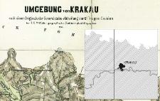
Title: Umgebung von Krakau : nach einem Originale der Generalstabs-Abtheilung der 12t Truppen Division
Creator:
Kaiserlich-Königliches Militär-Geographisches Institut (Wiedeń)
Date issued/created:
Resource type:
Publisher:
Place of publishing:
Description:
Skala [ca 1:28 800] ; 1 map on 4 sheets : photolithogr., col. ; sheets 54x57 cm or smaller, total 98x103 cm ; On the right head sheet title and legend of signs ; Map in German and Polish, legend in German ; Cited in: Centralny katalog zbiorów kartograficznych w Polsce, Z. 5, poz. 157, p. 75
Detailed Resource Type:
Format:
File size 11,5 MB ; image/x.djvu
Resource Identifier:
Source:
CBGiOŚ. IGiPZ PAN, call no. D.6592 [IX.7h/1-4] ; click here to follow the link
Language:
Rights:
Terms of use:
Digitizing institution:
Institute of Geography and Spatial Organization of the Polish Academy of Sciences
Original in:
Projects co-financed by:
Programme Innovative Economy, 2010-2014, Priority Axis 2. R&D infrastructure ; European Union. European Regional Development Fund
Access:
Object collections:
- Digital Repository of Scientific Institutes > Partners' collections > Institute of Geography and Spatial Organization PAS (IGiPZ PAN) > Library
- Digital Repository of Scientific Institutes > Partners' collections > Institute of Geography and Spatial Organization PAS (IGiPZ PAN) > Library > Maps and atlases
- Digital Repository of Scientific Institutes > Literature > Maps/Atlases
Last modified:
Oct 2, 2020
In our library since:
Jul 26, 2012
Number of object content downloads / hits:
176
All available object's versions:
https://rcin.org.pl./publication/15809
Show description in RDF format:
Show description in RDFa format:
Show description in OAI-PMH format:
| Edition name | Date |
|---|---|
| Umgebung von Krakau : nach einem Originale der Generalstabs-Abtheilung der 12t Truppen Division, 1867 | Oct 2, 2020 |
Objects Similar
Woźny, Marzena
Kaiserlich-Königliches Militär-Geographisches Institut (Wiedeń). Wydawca
Kaiserlich-Königliches Militär-Geographisches Institut (Wiedeń). Instytucja sprawcza Wydawca
Kaiserlich-Königliches Militär-Geographisches Institut (Wiedeń). Instytucja sprawcza. Wydawca
Kaiserlich-Königliches Militär-Geographisches Institut (Wiedeń). Instytucja sprawcza. Wydawca
Kaiserlich-Königliches Militär-Geographisches Institut (Wiedeń). Instytucja sprawcza. Wydawca
Kaiserlich-Königliches Militär-Geographisches Institut (Wiedeń). Instytucja sprawcza. Wydawca
Kaiserlich-Königliches Militär-Geographisches Institut (Wiedeń). Instytucja sprawcza. Wydawca

 INSTYTUT ARCHEOLOGII I ETNOLOGII POLSKIEJ AKADEMII NAUK
 INSTYTUT BADAŃ LITERACKICH POLSKIEJ AKADEMII NAUK
 INSTYTUT BADAWCZY LEŚNICTWA
 INSTYTUT BIOLOGII DOŚWIADCZALNEJ IM. MARCELEGO NENCKIEGO POLSKIEJ AKADEMII NAUK
 INSTYTUT BIOLOGII SSAKÓW POLSKIEJ AKADEMII NAUK
 INSTYTUT CHEMII FIZYCZNEJ PAN
 INSTYTUT CHEMII ORGANICZNEJ PAN
 INSTYTUT FILOZOFII I SOCJOLOGII PAN
 INSTYTUT GEOGRAFII I PRZESTRZENNEGO ZAGOSPODAROWANIA PAN
 INSTYTUT HISTORII im. TADEUSZA MANTEUFFLA POLSKIEJ AKADEMII NAUK
 INSTYTUT JĘZYKA POLSKIEGO POLSKIEJ AKADEMII NAUK
 INSTYTUT MATEMATYCZNY PAN
 INSTYTUT MEDYCYNY DOŚWIADCZALNEJ I KLINICZNEJ IM.MIROSŁAWA MOSSAKOWSKIEGO POLSKIEJ AKADEMII NAUK
 INSTYTUT PODSTAWOWYCH PROBLEMÓW TECHNIKI PAN
 INSTYTUT SLAWISTYKI PAN
 SIEĆ BADAWCZA ŁUKASIEWICZ - INSTYTUT TECHNOLOGII MATERIAŁÓW ELEKTRONICZNYCH
 MUZEUM I INSTYTUT ZOOLOGII POLSKIEJ AKADEMII NAUK
 INSTYTUT BADAŃ SYSTEMOWYCH PAN
 INSTYTUT BOTANIKI IM. WŁADYSŁAWA SZAFERA POLSKIEJ AKADEMII NAUK


