- Search in all Repository
- Literature and maps
- Archeology
- Mills database
- Natural sciences
Advanced search
Advanced search
Advanced search
Advanced search
Advanced search

Object
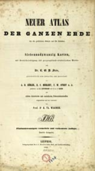
Title: Neuer Atlas der ganzen Erde : für die gebildeten Stände und für Schulen : siebenundzwanzig Karten mit Berücksichtigung der geographisch-statistischen Werke
Creator:
Stein, Christian Gottfried Daniel (1771–1830) ; Wagner, K. Th. Oprac. ; Köhler, A. Hugo. Rys. ; Baehr, Johann Leopold von (1793–1893) : Ryt. ; Leutemann, Heinrich, Ryt.
Date issued/created:
Resource type:
Publisher:
Verlagseigenthum der J. C. Hinrichs'schen Buch- und Landkartenhandlung
Place of publishing:
Description:
25 vermehrte und verbesserte Auflage. Zweite Ausgabe ; Scales differ ; 1 atlas (4 l., [7] folded leaves of plates, [27] folded leaves of maps) : copperplate engraving, hand col. maps ; 42 cm
Detailed Resource Type:
Format:
Resource Identifier:
Source:
CBGiOŚ. IGiPZ PAN, call no. B.1306 ; click here to follow the link
Language:
Rights:
Terms of use:
Digitizing institution:
Institute of Geography and Spatial Organization of the Polish Academy of Sciences
Original in:
Projects co-financed by:
Programme Innovative Economy, 2010-2014, Priority Axis 2. R&D infrastructure ; European Union. European Regional Development Fund
Access:
Object collections:
- Digital Repository of Scientific Institutes > Partners' collections > Institute of Geography and Spatial Organization PAS (IGiPZ PAN) > Library
- Digital Repository of Scientific Institutes > Partners' collections > Institute of Geography and Spatial Organization PAS (IGiPZ PAN) > Library > Maps and atlases
- Digital Repository of Scientific Institutes > Literature > Maps/Atlases
Last modified:
Oct 2, 2020
In our library since:
May 20, 2014
Number of object content downloads / hits:
242
All available object's versions:
https://rcin.org.pl./publication/15739
Show description in RDF format:
Show description in RDFa format:
Show description in OAI-PMH format:
Objects Similar
Stein, Christian Gottfried Daniel (1771–1830) Wagner, K. Th. Oprac. Baehr, Johann Leopold von (1793–1893) Heck, Johann Georg (1795–1857)
Samborska-Kukuć, Dorota Jaros, Maja Giebułtowski, Jerzy
Stein, Christian Gottfried Daniel (1771–1830)
Stein, Christian Gottfried Daniel (1771–1830)
Kozenn, Blasius (1821–1871) Gustawicz, Bronisław (1852–1916) Janota, Eugeniusz (1823–1878)
Stieler, Adolf (1775–1836) Perthes, Johan Georg Justus (1749–1816) Berghaus, Hermann (1828–1890) Poppey, Carl (1829–1875)
Petri, Èduard Ûl'evič (1854–1899)
Petri, Èduard Ûl'evič (1854–1899)

 INSTYTUT ARCHEOLOGII I ETNOLOGII POLSKIEJ AKADEMII NAUK
 INSTYTUT BADAŃ LITERACKICH POLSKIEJ AKADEMII NAUK
 INSTYTUT BADAWCZY LEŚNICTWA
 INSTYTUT BIOLOGII DOŚWIADCZALNEJ IM. MARCELEGO NENCKIEGO POLSKIEJ AKADEMII NAUK
 INSTYTUT BIOLOGII SSAKÓW POLSKIEJ AKADEMII NAUK
 INSTYTUT CHEMII FIZYCZNEJ PAN
 INSTYTUT CHEMII ORGANICZNEJ PAN
 INSTYTUT FILOZOFII I SOCJOLOGII PAN
 INSTYTUT GEOGRAFII I PRZESTRZENNEGO ZAGOSPODAROWANIA PAN
 INSTYTUT HISTORII im. TADEUSZA MANTEUFFLA POLSKIEJ AKADEMII NAUK
 INSTYTUT JĘZYKA POLSKIEGO POLSKIEJ AKADEMII NAUK
 INSTYTUT MATEMATYCZNY PAN
 INSTYTUT MEDYCYNY DOŚWIADCZALNEJ I KLINICZNEJ IM.MIROSŁAWA MOSSAKOWSKIEGO POLSKIEJ AKADEMII NAUK
 INSTYTUT PODSTAWOWYCH PROBLEMÓW TECHNIKI PAN
 INSTYTUT SLAWISTYKI PAN
 SIEĆ BADAWCZA ŁUKASIEWICZ - INSTYTUT TECHNOLOGII MATERIAŁÓW ELEKTRONICZNYCH
 MUZEUM I INSTYTUT ZOOLOGII POLSKIEJ AKADEMII NAUK
 INSTYTUT BADAŃ SYSTEMOWYCH PAN
 INSTYTUT BOTANIKI IM. WŁADYSŁAWA SZAFERA POLSKIEJ AKADEMII NAUK


