- Search in all Repository
- Literature and maps
- Archeology
- Mills database
- Natural sciences
Advanced search
Advanced search
Advanced search
Advanced search
Advanced search

Object
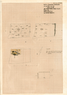
KZG, VI 301 B D, plan archeologiczny wykopu
Resource type:
Name:
KZG, VI 301 B D, plan archeologiczny wykopu
Other names:
Kalisz-Zawodzie-Grodzisko : dokumentacja terenowa - rysunki
Type of object:
Archaelogical site:
Site-locality-cutting/cut:
Site-locality-sector:
Site-locality-ar:
Site-locality-quarter:
Site-locality-depth:
102,94-102,66 m n.p.m. ; 102,96-102,72 m n.p.m. ; 102,77-102,41 m n.p.m.
Location:
Object type:
plan archeologiczny wykopu (na trzech poziomach)
Object description:
Research Manager/ Creator of Collection:
Author (of drawing, photo, record):
Data:
Accession number:
Chronology:
Relation:
Badania archeologiczne w Kaliszu
Detailed Resource Type:
Resource Identifier:
Rights:
Creative Commons Attribution BY-SA 3.0 PL license
Terms of use:
Copyright-protected material. [CC BY-SA 3.0 PL] May be used within the scope specified in Creative Commons Attribution BY-SA 3.0 PL license, full text available at: ; -
Digitizing institution:
Institute of Archaeology and Ethnology of the Polish Academy of Sciences
Original in:
Institute of Archaeology and Ethnology of the Polish Academy of Sciences
Projects co-financed by:
Operational Program Digital Poland, 2014-2020, Measure 2.3: Digital accessibility and usefulness of public sector information; funds from the European Regional Development Fund and national co-financing from the state budget. ; European Union. European Regional Development Fund
Access:
Object collections:
- Digital Repository of Scientific Institutes > Scientific data and objects > Humanities and Social Sciences > Archaeological collections
- Digital Repository of Scientific Institutes > Partners' collections > Institute of Archeology and Ethnology PAS > Archaeological research materials > Archaeological excavations in Kalisz
Last modified:
Oct 27, 2022
In our library since:
May 31, 2020
Number of object content downloads / hits:
15
All available object's versions:
https://rcin.org.pl./publication/157044
Show description in RDF format:
Show description in RDFa format:
Show description in OAI-PMH format:
| Edition name | Date |
|---|---|
| KZG, VI 301 B D, plan archeologiczny wykopu | Oct 27, 2022 |
Objects Similar
KZG, I 297 ABCD, plan archeologiczny wykopu średniowiecze wczesne
KZG, VI 301 C D, plan archeologiczny wykopu średniowiecze wczesne
KZG, VI 301 C D, plan archeologiczny wykopu średniowiecze wczesne
KZG, VI 301 C, plan archeologiczny wykopu średniowiecze wczesne
KZG, I 199, 198, 298, 297, 296, 295, 294, 394, 393, ABCD, profil archeologiczny E wykopu, plany fragmentów wałów średniowiecze wczesne
KZG, VI 301 D, profil archeologiczny N wykopu średniowiecze wczesne
KZG, IV 98 A B, 99 A, profil archeologiczny W wykopu średniowiecze wczesne

 INSTYTUT ARCHEOLOGII I ETNOLOGII POLSKIEJ AKADEMII NAUK
 INSTYTUT BADAŃ LITERACKICH POLSKIEJ AKADEMII NAUK
 INSTYTUT BADAWCZY LEŚNICTWA
 INSTYTUT BIOLOGII DOŚWIADCZALNEJ IM. MARCELEGO NENCKIEGO POLSKIEJ AKADEMII NAUK
 INSTYTUT BIOLOGII SSAKÓW POLSKIEJ AKADEMII NAUK
 INSTYTUT CHEMII FIZYCZNEJ PAN
 INSTYTUT CHEMII ORGANICZNEJ PAN
 INSTYTUT FILOZOFII I SOCJOLOGII PAN
 INSTYTUT GEOGRAFII I PRZESTRZENNEGO ZAGOSPODAROWANIA PAN
 INSTYTUT HISTORII im. TADEUSZA MANTEUFFLA POLSKIEJ AKADEMII NAUK
 INSTYTUT JĘZYKA POLSKIEGO POLSKIEJ AKADEMII NAUK
 INSTYTUT MATEMATYCZNY PAN
 INSTYTUT MEDYCYNY DOŚWIADCZALNEJ I KLINICZNEJ IM.MIROSŁAWA MOSSAKOWSKIEGO POLSKIEJ AKADEMII NAUK
 INSTYTUT PODSTAWOWYCH PROBLEMÓW TECHNIKI PAN
 INSTYTUT SLAWISTYKI PAN
 SIEĆ BADAWCZA ŁUKASIEWICZ - INSTYTUT TECHNOLOGII MATERIAŁÓW ELEKTRONICZNYCH
 MUZEUM I INSTYTUT ZOOLOGII POLSKIEJ AKADEMII NAUK
 INSTYTUT BADAŃ SYSTEMOWYCH PAN
 INSTYTUT BOTANIKI IM. WŁADYSŁAWA SZAFERA POLSKIEJ AKADEMII NAUK


