- Search in all Repository
- Literature and maps
- Archeology
- Mills database
- Natural sciences
Advanced search
Advanced search
Advanced search
Advanced search
Advanced search

Object
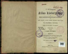
Title: F. W. Putzgera Atlas historyczny do dziejów starożytnych, średniowiecznych i nowożytnych dla użytku wyższych i średnich zakładów naukowych Austro-Węgier ; Atlas historyczny do dziejów starożytnych, średniowiecznych i nowożytnych
Creator:
Putzger, Friedrich Wilhelm (1849–1913) ; Baldamus, Alfred (1856–1908) : Wyd. ; Schwab, Ernest : Wyd. ; Lewicki, J. : Oprac. (kartografia) ; Bojarski, Wł : Oprac.
Date issued/created:
Resource type:
Publisher:
nakł. Wdowy po A. Pichlerze i Syna
Place of publishing:
Description:
Wyd. 3, wyd. polskie ; Scales differ ; 1 atlas (X p., 32 l.) : maps col. ; 27 cm ; Subtitle: Zawiera 52 map wielkich i 61 mniejszych
Detailed Resource Type:
Format:
File size 31,9 MB ; image/x.djvu
Resource Identifier:
Source:
CBGiOŚ. IGiPZ PAN, sygn. B.KS.252 ; click here to follow the link
Language:
Rights:
Terms of use:
Digitizing institution:
Institute of Geography and Spatial Organization of the Polish Academy of Sciences
Original in:
Projects co-financed by:
Programme Innovative Economy, 2010-2014, Priority Axis 2. R&D infrastructure ; European Union. European Regional Development Fund
Access:
Object collections:
- Digital Repository of Scientific Institutes > Partners' collections > Institute of Geography and Spatial Organization PAS (IGiPZ PAN) > Library
- Digital Repository of Scientific Institutes > Partners' collections > Institute of Geography and Spatial Organization PAS (IGiPZ PAN) > Library > Maps and atlases
- Digital Repository of Scientific Institutes > Partners' collections > Institute of Geography and Spatial Organization PAS (IGiPZ PAN) > Library > Selected collections > Prof. Józef Staszewski Collection
- Digital Repository of Scientific Institutes > Literature > Maps/Atlases
Last modified:
Oct 2, 2020
In our library since:
Feb 24, 2012
Number of object content downloads / hits:
721
All available object's versions:
https://rcin.org.pl./publication/11140
Show description in RDF format:
Show description in RDFa format:
Show description in OAI-PMH format:
Objects Similar
Putzger, Friedrich Wilhelm (1849–1913) Baldamus, Alfred (1856–1908) Schwabe, Ernst (1858–1927) Koch, Julius (1866– )
Putzger, Friedrich Wilhelm (1849–1913) Pehle, Max (1881–1939) Silberborth, Hans (1887–1949)
Putzger, Friedrich Wilhelm (1849–1913)
Putzger, Friedrich Wilhelm (1849–1913) Pehle, Max (1881–1939) Silberborth, Hans (1887–1949) Iskraut, Martin
Putzger, Friedrich Wilhelm (1849–1913) Pehle, Max (1881–1939) Silberborth, Hans (1887–1949)

 INSTYTUT ARCHEOLOGII I ETNOLOGII POLSKIEJ AKADEMII NAUK
 INSTYTUT BADAŃ LITERACKICH POLSKIEJ AKADEMII NAUK
 INSTYTUT BADAWCZY LEŚNICTWA
 INSTYTUT BIOLOGII DOŚWIADCZALNEJ IM. MARCELEGO NENCKIEGO POLSKIEJ AKADEMII NAUK
 INSTYTUT BIOLOGII SSAKÓW POLSKIEJ AKADEMII NAUK
 INSTYTUT CHEMII FIZYCZNEJ PAN
 INSTYTUT CHEMII ORGANICZNEJ PAN
 INSTYTUT FILOZOFII I SOCJOLOGII PAN
 INSTYTUT GEOGRAFII I PRZESTRZENNEGO ZAGOSPODAROWANIA PAN
 INSTYTUT HISTORII im. TADEUSZA MANTEUFFLA POLSKIEJ AKADEMII NAUK
 INSTYTUT JĘZYKA POLSKIEGO POLSKIEJ AKADEMII NAUK
 INSTYTUT MATEMATYCZNY PAN
 INSTYTUT MEDYCYNY DOŚWIADCZALNEJ I KLINICZNEJ IM.MIROSŁAWA MOSSAKOWSKIEGO POLSKIEJ AKADEMII NAUK
 INSTYTUT PODSTAWOWYCH PROBLEMÓW TECHNIKI PAN
 INSTYTUT SLAWISTYKI PAN
 SIEĆ BADAWCZA ŁUKASIEWICZ - INSTYTUT TECHNOLOGII MATERIAŁÓW ELEKTRONICZNYCH
 MUZEUM I INSTYTUT ZOOLOGII POLSKIEJ AKADEMII NAUK
 INSTYTUT BADAŃ SYSTEMOWYCH PAN
 INSTYTUT BOTANIKI IM. WŁADYSŁAWA SZAFERA POLSKIEJ AKADEMII NAUK


