- Search in all Repository
- Literature and maps
- Archeology
- Mills database
- Natural sciences
Advanced search
Advanced search
Advanced search
Advanced search
Advanced search

Object
Available formats:
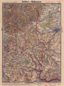
Download allTitle: Paasche's Spezialkarten der Westfront (Belgien und Frankreich) : Maßstab 1:105 000. Blatt 12, Belfort - Mülhausen
Creator:
Paasche, Walter (18..-1932). Redaktor ; Paasche & Luz Kartographische Anstalt. Wydawca
Date issued/created:
Resource type:
Subtitle:
Paasche's Spezialkarten der Westfront. Blatt 12, Belfort - Mülhausen ; Belfort - Mülhausen
Publisher:
Place of publishing:
Description:
Scale 1:105 000 ; 1 map : color ; sheet 60x45 cm, folded to 15x11 cm ; Annotation on the map: nach den deutschen, belgischen und franzöischen Generalstabskarten neu gezeichnet ; Fünffarbiger Druck mit Eintrag der multmaßlichen Frontlinie und Textbeilage ; 12 Blätter ; In the margin: II.18
Relation:
Paasche's Spezialkarten der Westfront (Belgien und Frankreich) : 12 Blätter
Detailed Resource Type:
Format:
Resource Identifier:
Source:
CBGiOŚ. IGiPZ PAN, call no. C.458[12] ; click here to follow the link
Language:
Rights:
Terms of use:
Digitizing institution:
Institute of Geography and Spatial Organization of the Polish Academy of Sciences
Original in:
Projects co-financed by:
Access:
Object collections:
- Digital Repository of Scientific Institutes > Partners' collections > Institute of Geography and Spatial Organization PAS (IGiPZ PAN) > Library
- Digital Repository of Scientific Institutes > Partners' collections > Institute of Geography and Spatial Organization PAS (IGiPZ PAN) > Library > Maps and atlases
- Digital Repository of Scientific Institutes > Literature > Maps/Atlases
Last modified:
Oct 2, 2020
In our library since:
Dec 18, 2019
Number of object content downloads / hits:
63
All available object's versions:
https://rcin.org.pl./publication/89952
Show description in RDF format:
Show description in RDFa format:
Show description in OAI-PMH format:
| Edition name | Date |
|---|---|
| Paasche's Spezialkarten der Westfront (Belgien und Frankreich). Blatt 12, Belfort - Mülhausen, [1918] | Oct 2, 2020 |
Objects Similar
Paasche, Walter (18..-1932). Redaktor Paasche & Luz Kartographische Anstalt. Wydawca
Paasche, Walter (18..-1932). Redaktor Paasche & Luz Kartographische Anstalt. Wydawca
Paasche, Walter (18..-1932). Redaktor Paasche & Luz Kartographische Anstalt. Wydawca
Paasche, Walter (18..-1932). Redaktor Paasche & Luz Kartographische Anstalt. Wydawca
Paasche, Walter (18..-1932). Redaktor Paasche & Luz Kartographische Anstalt. Wydawca
Paasche, Walter (18..-1932). Redaktor Paasche & Luz Kartographische Anstalt. Wydawca
Paasche, Walter (18..-1932). Redaktor Paasche & Luz Kartographische Anstalt. Wydawca
Paasche, Walter (18..-1932). Redaktor Paasche & Luz Kartographische Anstalt. Wydawca

 INSTYTUT ARCHEOLOGII I ETNOLOGII POLSKIEJ AKADEMII NAUK
 INSTYTUT BADAŃ LITERACKICH POLSKIEJ AKADEMII NAUK
 INSTYTUT BADAWCZY LEŚNICTWA
 INSTYTUT BIOLOGII DOŚWIADCZALNEJ IM. MARCELEGO NENCKIEGO POLSKIEJ AKADEMII NAUK
 INSTYTUT BIOLOGII SSAKÓW POLSKIEJ AKADEMII NAUK
 INSTYTUT CHEMII FIZYCZNEJ PAN
 INSTYTUT CHEMII ORGANICZNEJ PAN
 INSTYTUT FILOZOFII I SOCJOLOGII PAN
 INSTYTUT GEOGRAFII I PRZESTRZENNEGO ZAGOSPODAROWANIA PAN
 INSTYTUT HISTORII im. TADEUSZA MANTEUFFLA POLSKIEJ AKADEMII NAUK
 INSTYTUT JĘZYKA POLSKIEGO POLSKIEJ AKADEMII NAUK
 INSTYTUT MATEMATYCZNY PAN
 INSTYTUT MEDYCYNY DOŚWIADCZALNEJ I KLINICZNEJ IM.MIROSŁAWA MOSSAKOWSKIEGO POLSKIEJ AKADEMII NAUK
 INSTYTUT PODSTAWOWYCH PROBLEMÓW TECHNIKI PAN
 INSTYTUT SLAWISTYKI PAN
 SIEĆ BADAWCZA ŁUKASIEWICZ - INSTYTUT TECHNOLOGII MATERIAŁÓW ELEKTRONICZNYCH
 MUZEUM I INSTYTUT ZOOLOGII POLSKIEJ AKADEMII NAUK
 INSTYTUT BADAŃ SYSTEMOWYCH PAN
 INSTYTUT BOTANIKI IM. WŁADYSŁAWA SZAFERA POLSKIEJ AKADEMII NAUK


