- Search in all Repository
- Literature and maps
- Archeology
- Mills database
- Natural sciences
Advanced search
Advanced search
Advanced search
Advanced search
Advanced search

Object
Available formats:
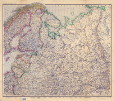
Download allTitle: Osteuropa und Vorder-Asien : Nordblatt
Publisher:
Place of publishing:
Description:
Skala 1:3 000 000 ; 1 mapa : kolorowa ; 75x89 cm, na arkuszu 83x94 cm ; Na dolnym marginesie: Grenzen innerhalb der Sowjetunion gemäsß sdem Stande vor dem 22. Juni 1941. Stand 5.5.43. W dolnym narożniku ramki: IV/1943
Detailed Resource Type:
Format:
Resource Identifier:
Source:
CBGiOŚ. IGiPZ PAN, sygn. PTG D.839 ; click here to follow the link
Language:
Coverage:
Rights:
Terms of use:
Digitizing institution:
Instytut Geografii i Przestrzennego Zagospodarowania Polskiej Akademii Nauk
Original in:
Projects co-financed by:
Access:
Object collections:
- Digital Repository of Scientific Institutes > Partners' collections > Institute of Geography and Spatial Organization PAS (IGiPZ PAN) > Library
- Digital Repository of Scientific Institutes > Partners' collections > Institute of Geography and Spatial Organization PAS (IGiPZ PAN) > Library > Maps and atlases
- Digital Repository of Scientific Institutes > Partners' collections > Institute of Geography and Spatial Organization PAS (IGiPZ PAN) > Library > Selected collections > Polish Geographical Society Collection
- Digital Repository of Scientific Institutes > Literature > Maps/Atlases
Last modified:
Oct 2, 2020
In our library since:
Jan 3, 2020
Number of object content downloads / hits:
76
All available object's versions:
https://rcin.org.pl./publication/89432
Show description in RDF format:
Show description in RDFa format:
Show description in OAI-PMH format:
| Edition name | Date |
|---|---|
| Osteuropa und Vorder-Asien : Nordblatt, 1943 | Oct 2, 2020 |
Objects Similar
Bibliographisches Institut (Lipsk). Wydawca
Ravenstein Geographische Verlagsanstalt und Druckerei. Wydawca
Ravenstein Geographische Verlagsanstalt und Druckerei. Wydawca
Fischer, Hans (1860–1941) Erdmann, Curt Winkel, Oswald (1874–1953)
Stany Zjednoczone. Army Map Service. Wydawca Stany Zjednoczone. Army. Office of the Chief Engineers. Redaktor

 INSTYTUT ARCHEOLOGII I ETNOLOGII POLSKIEJ AKADEMII NAUK
 INSTYTUT BADAŃ LITERACKICH POLSKIEJ AKADEMII NAUK
 INSTYTUT BADAWCZY LEŚNICTWA
 INSTYTUT BIOLOGII DOŚWIADCZALNEJ IM. MARCELEGO NENCKIEGO POLSKIEJ AKADEMII NAUK
 INSTYTUT BIOLOGII SSAKÓW POLSKIEJ AKADEMII NAUK
 INSTYTUT CHEMII FIZYCZNEJ PAN
 INSTYTUT CHEMII ORGANICZNEJ PAN
 INSTYTUT FILOZOFII I SOCJOLOGII PAN
 INSTYTUT GEOGRAFII I PRZESTRZENNEGO ZAGOSPODAROWANIA PAN
 INSTYTUT HISTORII im. TADEUSZA MANTEUFFLA POLSKIEJ AKADEMII NAUK
 INSTYTUT JĘZYKA POLSKIEGO POLSKIEJ AKADEMII NAUK
 INSTYTUT MATEMATYCZNY PAN
 INSTYTUT MEDYCYNY DOŚWIADCZALNEJ I KLINICZNEJ IM.MIROSŁAWA MOSSAKOWSKIEGO POLSKIEJ AKADEMII NAUK
 INSTYTUT PODSTAWOWYCH PROBLEMÓW TECHNIKI PAN
 INSTYTUT SLAWISTYKI PAN
 SIEĆ BADAWCZA ŁUKASIEWICZ - INSTYTUT TECHNOLOGII MATERIAŁÓW ELEKTRONICZNYCH
 MUZEUM I INSTYTUT ZOOLOGII POLSKIEJ AKADEMII NAUK
 INSTYTUT BADAŃ SYSTEMOWYCH PAN
 INSTYTUT BOTANIKI IM. WŁADYSŁAWA SZAFERA POLSKIEJ AKADEMII NAUK


