- About project
- Collections
- Indexes
- Recently viewed
-
RCIN Repositories
-
 INSTYTUT ARCHEOLOGII I ETNOLOGII POLSKIEJ AKADEMII NAUK
-
 INSTYTUT BADAŃ LITERACKICH POLSKIEJ AKADEMII NAUK
-
 INSTYTUT BADAWCZY LEŚNICTWA
-
 INSTYTUT BIOLOGII DOŚWIADCZALNEJ IM. MARCELEGO NENCKIEGO POLSKIEJ AKADEMII NAUK
-
 INSTYTUT BIOLOGII SSAKÓW POLSKIEJ AKADEMII NAUK
-
 INSTYTUT CHEMII FIZYCZNEJ PAN
-
 INSTYTUT CHEMII ORGANICZNEJ PAN
-
 INSTYTUT FILOZOFII I SOCJOLOGII PAN
-
 INSTYTUT GEOGRAFII I PRZESTRZENNEGO ZAGOSPODAROWANIA PAN
-
 INSTYTUT HISTORII im. TADEUSZA MANTEUFFLA POLSKIEJ AKADEMII NAUK
-
 INSTYTUT JĘZYKA POLSKIEGO POLSKIEJ AKADEMII NAUK
-
 INSTYTUT MATEMATYCZNY PAN
-
 INSTYTUT MEDYCYNY DOŚWIADCZALNEJ I KLINICZNEJ IM.MIROSŁAWA MOSSAKOWSKIEGO POLSKIEJ AKADEMII NAUK
-
 INSTYTUT PODSTAWOWYCH PROBLEMÓW TECHNIKI PAN
-
 INSTYTUT SLAWISTYKI PAN
-
 SIEĆ BADAWCZA ŁUKASIEWICZ - INSTYTUT TECHNOLOGII MATERIAŁÓW ELEKTRONICZNYCH
-
 MUZEUM I INSTYTUT ZOOLOGII POLSKIEJ AKADEMII NAUK
-
 INSTYTUT BADAŃ SYSTEMOWYCH PAN
-
 INSTYTUT BOTANIKI IM. WŁADYSŁAWA SZAFERA POLSKIEJ AKADEMII NAUK
-
- Search in all Repository
- Literature and maps
- Archeology
- Mills database
- Natural sciences
Advanced search
Advanced search
Advanced search
Advanced search
Advanced search

Object
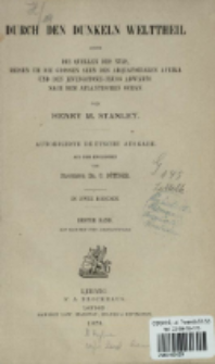
Title: Durch den dunkeln Welttheil : oder die Quellen des Nils, Reisen um die grossen seen des aequatorialen Afrika und den Livingstone-Fluss abwärts nach dem Atlantischen Ocean : in zwei Bänden. Bd. 1
Creator:
Stanley, Henry Morton (1841–1904) ; Böttger, Carl (1818–1881) : Tł. ; F. A. Brockhaus (Lipsk) ; Sampson Low, Marston, Searle, & Rivington.
Date issued/created:
Resource type:
Publisher:
F. A. Brockhaus ; Sampson Low, Marston, Searle & Rivington
Place of publishing:
Description:
Autorisirte deutsche Ausg. ; XX, 567, [1] s., [16] k. tabl., [5] k. map. : il. ; 22 cm ; Tyt. mapy: Aequatorial-Afrika (nach Dapper's Karte) 1676 ; Tyt. mapy: Krapf, Rebmann, Livingstone und Erhardt's Karte : 1849-56 ; Tyt. mapy: Livingstone, Burton & Speke, Speke & Grant & Von der Decken : 1856-63 ; Tyt. mapy: Schweinfurth, Baker, Livingstone, Stanley und Cameron : 1866-75 ; Tyt. mapy: Stanley : 1874-77 ; Mit Karten und Abbildungen ; Indeks
Detailed Resource Type:
Format:
Resource Identifier:
Source:
CBGiOŚ. IGiPZ PAN, call no. 4.237 ; click here to follow the link
Language:
Rights:
Terms of use:
Digitizing institution:
Institute of Geography and Spatial Organization of the Polish Academy of Sciences
Original in:
Projects co-financed by:
Access:
Object collections:
- Digital Repository of Scientific Institutes > Partners' collections > Institute of Geography and Spatial Organization PAS (IGiPZ PAN) > Library > Books
- Digital Repository of Scientific Institutes > Partners' collections > Institute of Geography and Spatial Organization PAS (IGiPZ PAN) > Library > Selected collections > Polish Geographical Society Collection
- Digital Repository of Scientific Institutes > Literature > Books/Chapters
Last modified:
Oct 2, 2020
In our library since:
Jan 9, 2019
Number of object content downloads / hits:
1053
All available object's versions:
https://rcin.org.pl./publication/6922
Show description in RDF format:
Show description in RDFa format:
Show description in OAI-PMH format:
Objects Similar
Stanley, Henry Morton (1841–1904) Grabowska, Zofia (?-1929) Redakcja "Wędrowca". Wydawca
Stanley, Henry Morton (1841–1904) Karl Grädener
Stanley, Henry Morton (1841–1904) Wobeser, Hugo von (1842–1897) F. A. Brockhaus (Lipsk)
Stanley, Henry Morton (1841–1904) Wobeser, Hugo von (1842–1897) F. A. Brockhaus (Lipsk)
Stanley, Henry Morton (1841–1904) Volz, Berthold (1839–1899) F. A. Brockhaus


