- Search in all Repository
- Literature and maps
- Archeology
- Mills database
- Natural sciences
Advanced search
Advanced search
Advanced search
Advanced search
Advanced search

Object
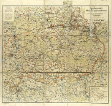
Title: Paul Raschdorff's Übersichts-, Gruben- und Hüttenkarte des oberschlesischen (preuss.) mährisch-ostrau-karwiner (österreich.) und russisch-polnischen Industriebezirks (Dreikaiserecke)
Contributor:
Publisher:
Place of publishing:
Description:
Skala 1:125 000 ; 1 mapa : litogr. kolor. ; na ark. 70x73 cm ; Tyt. z mapy w prawym górnym rogu ; Na mapie naniesiona siatka skorowidzowa ; Mapa ukazywała się także z tekstem objaśniającym: Beiheft zu Paul Raschdorff's Handkarte des oberschlesischen (preuss.), österreich.-schlesischen und russisch-polnischen Industriebezirks / Paul Raschdorff. - Kolberg, [ca 1899] ; W prawym dolnym rogu mapa poboczna: Übersichtsplan zur Hauptkarte w skali 1:2 750 000. W lewym górnym rogu legenda ; Pod dolną ramką: Lith. Osw. Melching, Leipzig ; Druck: Gebr. Lissel, Liepzig ; Data wyd. wg Historia nowożytnej kartografii Śląska 1800-1939 / Henryk Kot. - Katowice, 1970 poz. 232, s. 175 ; BNPol online
Detailed Resource Type:
Format:
File size 9,2 MB ; application/pdf
Resource Identifier:
Source:
CBGiOŚ. IGiPZ PAN, call no. D.11581 [II.7B-29] ; click here to follow the link
Language:
Rights:
Terms of use:
Digitizing institution:
Institute of Geography and Spatial Organization of the Polish Academy of Sciences
Original in:
Projects co-financed by:
Programme Innovative Economy, 2010-2014, Priority Axis 2. R&D infrastructure ; European Union. European Regional Development Fund
Access:
Object collections:
- Digital Repository of Scientific Institutes > Partners' collections > Institute of Geography and Spatial Organization PAS (IGiPZ PAN) > Library
- Digital Repository of Scientific Institutes > Partners' collections > Institute of Geography and Spatial Organization PAS (IGiPZ PAN) > Library > Maps and atlases
- Digital Repository of Scientific Institutes > Literature > Maps/Atlases
Last modified:
Oct 2, 2020
In our library since:
May 22, 2017
Number of object content downloads / hits:
760
All available object's versions:
https://rcin.org.pl./publication/52482
Show description in RDF format:
Show description in RDFa format:
Show description in OAI-PMH format:
Objects Similar
Samborska-Kukuć, Dorota Jaros, Maja Giebułtowski, Jerzy
Egloff, Jerzy
Osiecki, Jan (1827–1901)
Osiecki, Jan (1827–1901)
Woźny, Marzena

 INSTYTUT ARCHEOLOGII I ETNOLOGII POLSKIEJ AKADEMII NAUK
 INSTYTUT BADAŃ LITERACKICH POLSKIEJ AKADEMII NAUK
 INSTYTUT BADAWCZY LEŚNICTWA
 INSTYTUT BIOLOGII DOŚWIADCZALNEJ IM. MARCELEGO NENCKIEGO POLSKIEJ AKADEMII NAUK
 INSTYTUT BIOLOGII SSAKÓW POLSKIEJ AKADEMII NAUK
 INSTYTUT CHEMII FIZYCZNEJ PAN
 INSTYTUT CHEMII ORGANICZNEJ PAN
 INSTYTUT FILOZOFII I SOCJOLOGII PAN
 INSTYTUT GEOGRAFII I PRZESTRZENNEGO ZAGOSPODAROWANIA PAN
 INSTYTUT HISTORII im. TADEUSZA MANTEUFFLA POLSKIEJ AKADEMII NAUK
 INSTYTUT JĘZYKA POLSKIEGO POLSKIEJ AKADEMII NAUK
 INSTYTUT MATEMATYCZNY PAN
 INSTYTUT MEDYCYNY DOŚWIADCZALNEJ I KLINICZNEJ IM.MIROSŁAWA MOSSAKOWSKIEGO POLSKIEJ AKADEMII NAUK
 INSTYTUT PODSTAWOWYCH PROBLEMÓW TECHNIKI PAN
 INSTYTUT SLAWISTYKI PAN
 SIEĆ BADAWCZA ŁUKASIEWICZ - INSTYTUT TECHNOLOGII MATERIAŁÓW ELEKTRONICZNYCH
 MUZEUM I INSTYTUT ZOOLOGII POLSKIEJ AKADEMII NAUK
 INSTYTUT BADAŃ SYSTEMOWYCH PAN
 INSTYTUT BOTANIKI IM. WŁADYSŁAWA SZAFERA POLSKIEJ AKADEMII NAUK


