Object
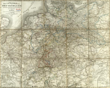
Title: Post und Eisenbahn - Karte von Deutschland und den anliegenden Lændern
Subtitle:
Deutschland ; Post und Eisenbahn - Karte von Deutschland und den anliegenden Ländern
Contributor:
Bär, Johann Christoph (1789–1848) : Oprac. ; Diez, Franz Maximilian (1767–1851) : Oprac. ; Justus Perthes (Gotha)
Publisher:
Place of publishing:
Description:
Scale [ca 1:2 300 000] ; 1 map ; 50x63 cm, folded in cover 13x18 cm ; Ancillary maps: Die Hauptrouten von Paris nach Neapel, Madrid ; Die Hauptrouten nach dem oestlichen Europ ; Ost-Preussen zur Vervollständigung der Hauptkarte ; On the back of the sheet there is a list of railway connections and distances between cities
Detailed Resource Type:
Format:
File size 10 MB ; image/x.djvu
Resource Identifier:
Source:
CBGiOŚ. IGiPZ PAN, call no. D.3446 ; click here to follow the link
Language:
Rights:
Terms of use:
Digitizing institution:
Institute of Geography and Spatial Organization of the Polish Academy of Sciences
Original in:
Projects co-financed by:
Programme Innovative Economy, 2010-2014, Priority Axis 2. R&D infrastructure ; European Union. European Regional Development Fund
Access:
Object collections:
- Digital Repository of Scientific Institutes > Partners' collections > Institute of Geography and Spatial Organization PAS (IGiPZ PAN) > Library
- Digital Repository of Scientific Institutes > Partners' collections > Institute of Geography and Spatial Organization PAS (IGiPZ PAN) > Library > Maps and atlases
- Digital Repository of Scientific Institutes > Literature > Maps/Atlases
Last modified:
Sep 13, 2021
In our library since:
Oct 25, 2016
Number of object content downloads / hits:
124
All available object's versions:
https://rcin.org.pl./publication/47055
Show description in RDF format:
Show description in RDFa format:
Show description in OAI-PMH format:
| Edition name | Date |
|---|---|
| Post und Eisenbahn - Karte von Deutschland und den anliegenden Lændern, 1854 | Sep 13, 2021 |
Objects Similar
Woźny, Marzena
Bis, Magdalena
Rada, Stanislav Trnka, Filip
Kaňuchová, Andrea Christophoryová, Jana Krajčovičová, Katarina
Skóra, Kalina
Buzalka, Juraj
Szczepanik, Paweł
Lesiński, Grzegorz Janus, Krzysztof

 INSTYTUT ARCHEOLOGII I ETNOLOGII POLSKIEJ AKADEMII NAUK
 INSTYTUT BADAŃ LITERACKICH POLSKIEJ AKADEMII NAUK
 INSTYTUT BADAWCZY LEŚNICTWA
 INSTYTUT BIOLOGII DOŚWIADCZALNEJ IM. MARCELEGO NENCKIEGO POLSKIEJ AKADEMII NAUK
 INSTYTUT BIOLOGII SSAKÓW POLSKIEJ AKADEMII NAUK
 INSTYTUT CHEMII FIZYCZNEJ PAN
 INSTYTUT CHEMII ORGANICZNEJ PAN
 INSTYTUT FILOZOFII I SOCJOLOGII PAN
 INSTYTUT GEOGRAFII I PRZESTRZENNEGO ZAGOSPODAROWANIA PAN
 INSTYTUT HISTORII im. TADEUSZA MANTEUFFLA POLSKIEJ AKADEMII NAUK
 INSTYTUT JĘZYKA POLSKIEGO POLSKIEJ AKADEMII NAUK
 INSTYTUT MATEMATYCZNY PAN
 INSTYTUT MEDYCYNY DOŚWIADCZALNEJ I KLINICZNEJ IM.MIROSŁAWA MOSSAKOWSKIEGO POLSKIEJ AKADEMII NAUK
 INSTYTUT PODSTAWOWYCH PROBLEMÓW TECHNIKI PAN
 INSTYTUT SLAWISTYKI PAN
 SIEĆ BADAWCZA ŁUKASIEWICZ - INSTYTUT TECHNOLOGII MATERIAŁÓW ELEKTRONICZNYCH
 MUZEUM I INSTYTUT ZOOLOGII POLSKIEJ AKADEMII NAUK
 INSTYTUT BADAŃ SYSTEMOWYCH PAN
 INSTYTUT BOTANIKI IM. WŁADYSŁAWA SZAFERA POLSKIEJ AKADEMII NAUK


