- Wyszukaj w całym Repozytorium
- Piśmiennictwo i mapy
- Archeologia
- Baza Młynów
- Nauki przyrodnicze
Wyszukiwanie zaawansowane
Wyszukiwanie zaawansowane
Wyszukiwanie zaawansowane
Wyszukiwanie zaawansowane
Wyszukiwanie zaawansowane

Obiekt
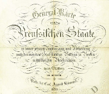
Tytuł: General-Karte von dem Preussischen Staate in seiner jetzigen Begraenzung und Abteilung, nach den von dem Staatistischen Bureau zu Berlin mitgetheilten Nachrichten, in 24 Blaettern neu entworfen
Publisher:
Place of publishing:
Description:
Scale 1:600 000 ; 1 map on 24 sheets : copperplate engraving, hand col. ; on sheets 38x40 cm or smaller+ 1 sheet with index map, 12x16 cm ; Index map: Übersicht zur Zusammensetzung der Karte des Preussischen Staats. - Halle, 1818 ; Date on the title sheet: 1820 ; Sect 1: H. Kliewer sculps, Wasser v. F. Reyher. Sect 2: Situation v. Bimbè, Wasser v. F. Reyher gest., Schrift v. H. Leutemann. Sect 3: gest. v. Jäck. Sect 4: gest. v. Jäck. Sect 6: gestochen von Carl Jättnig sen. in Berlin. Sect 7: Situation von Bimbè, Wasser v. F. Reyher, L'Ecriture grave par Aubert Junior a' Paris. Sect 8: Situation von Bimbè, Wasser v. F. Reyher, Ecrit par Aubert Junior a' Paris. Sect 9: Schrift gestochen von H. Kliewer, Situation v. Bimbè. Sect 10: gestochen von Paulus Schmidt in Berlin. Sect 11: Situation v. Bimbè, Schrift von H. Kliewer. Sect 12: Situation v. Bimbè, Schrift von Leutemann. Sect 13: die Berge von K. Kolbe gestochen, Situation v. Bimbè, Schrift von H. Kliewer. Sect 14: die Berge von K. Kolbe, Schrift von H. Kliewer, Situation von Bimbè. Sect 15: Situation und Schrift von Heinrich Kliewer, die Berge v. K. Kolbe gest in Berlin. Sect 16: Situation von Bimbè, Schrift von H. Kliewer. Sect 17: Situation von Bimbè, Schrift von H. Kliewer. Sect 18 Schrift von Paulus Schmidt, Situation und Ausarbeitungen von Bimbè. Sect 19: Schrift von H. Kliewer, Berge von K. Kolbe, Situation von Bimbè. Sect 20: Schrift von Kliewer, Berge von K. Kolbe, Situation von Bimbè gestochen. Sect 21: Situation von Bimbè, Schrift v. H. Kliewer, die Berge von K. Kolbe. Sect 22: die Berge von K. Kolbe, schrift von H. Kliewer, Bimbè situat. Sect 23: Paulus Schmidt sc. Sect 24: gestochen von H. Kliewer ; Cited in: Centralny Katalog Zbiorów Kartograficznych w Polsce, Z. 5, poz. 73
Detailed Resource Type:
Format:
File size 48,5 MB ; image/x.djvu
Resource Identifier:
Source:
CBGiOŚ. IGiPZ PAN, call no. C.645[1-24] [IX.9-l] ; kliknij tutaj, żeby przejść
Language:
Rights:
Terms of use:
Digitizing institution:
Institute of Geography and Spatial Organization of the Polish Academy of Sciences
Original in:
Projects co-financed by:
Programme Innovative Economy, 2010-2014, Priority Axis 2. R&D infrastructure ; European Union. European Regional Development Fund
Access:
Kolekcje, do których przypisany jest obiekt:
- Digital Repository of Scientific Institutes > Partners' collections > Institute of Geography and Spatial Organization PAS (IGiPZ PAN) > Library
- Digital Repository of Scientific Institutes > Partners' collections > Institute of Geography and Spatial Organization PAS (IGiPZ PAN) > Library > Maps and atlases
- Digital Repository of Scientific Institutes > Literature > Maps/Atlases
Data ostatniej modyfikacji:
Oct 2, 2020
Data dodania obiektu:
Dec 1, 2011
Liczba pobrań / odtworzeń:
813
Wszystkie dostępne wersje tego obiektu:
https://rcin.org.pl./publication/4409
Wyświetl opis w formacie RDF:
Wyświetl opis w formacie RDFa:
Wyświetl opis w formacie OAI-PMH:
Obiekty Podobne
Engelhardt, Friedrich Bernhard (1768–1854)
Engelhardt, Friedrich Bernhard (1768–1854) Schmidt, Paulus Maré, Carl (fl. 1804-1845)
Karte von dem Königreich Pohlen, Gross-Herzogthum Posen und den angrenzenden Staaten in IV Sectionen
Engelhardt, Friedrich Bernhard (1768–1854) Maré, Carl (fl. 1804-1845) Schmidt, Paulus
Samborska-Kukuć, Dorota Jaros, Maja Giebułtowski, Jerzy
Liechtenstern, Joseph Marx von (1765–1828) Hartl, Martin (18..-19..). Rys.
Woźny, Marzena
Handtke, Friedrich H. (1815–1879)

 INSTYTUT ARCHEOLOGII I ETNOLOGII POLSKIEJ AKADEMII NAUK
 INSTYTUT BADAŃ LITERACKICH POLSKIEJ AKADEMII NAUK
 INSTYTUT BADAWCZY LEŚNICTWA
 INSTYTUT BIOLOGII DOŚWIADCZALNEJ IM. MARCELEGO NENCKIEGO POLSKIEJ AKADEMII NAUK
 INSTYTUT BIOLOGII SSAKÓW POLSKIEJ AKADEMII NAUK
 INSTYTUT CHEMII FIZYCZNEJ PAN
 INSTYTUT CHEMII ORGANICZNEJ PAN
 INSTYTUT FILOZOFII I SOCJOLOGII PAN
 INSTYTUT GEOGRAFII I PRZESTRZENNEGO ZAGOSPODAROWANIA PAN
 INSTYTUT HISTORII im. TADEUSZA MANTEUFFLA POLSKIEJ AKADEMII NAUK
 INSTYTUT JĘZYKA POLSKIEGO POLSKIEJ AKADEMII NAUK
 INSTYTUT MATEMATYCZNY PAN
 INSTYTUT MEDYCYNY DOŚWIADCZALNEJ I KLINICZNEJ IM.MIROSŁAWA MOSSAKOWSKIEGO POLSKIEJ AKADEMII NAUK
 INSTYTUT PODSTAWOWYCH PROBLEMÓW TECHNIKI PAN
 INSTYTUT SLAWISTYKI PAN
 SIEĆ BADAWCZA ŁUKASIEWICZ - INSTYTUT TECHNOLOGII MATERIAŁÓW ELEKTRONICZNYCH
 MUZEUM I INSTYTUT ZOOLOGII POLSKIEJ AKADEMII NAUK
 INSTYTUT BADAŃ SYSTEMOWYCH PAN
 INSTYTUT BOTANIKI IM. WŁADYSŁAWA SZAFERA POLSKIEJ AKADEMII NAUK


