- Search in all Repository
- Literature and maps
- Archeology
- Mills database
- Natural sciences
Advanced search
Advanced search
Advanced search
Advanced search
Advanced search

Object
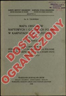
Title: Mapa obszarów naftowych i gazowych Polski w Karpatach i na Przedgórzu : skala 1:500.000 : tekst objaśniajacy = Carte des régions pétrolifères et gazeuses de la Pologne dans les Karpates et sur l'avant - pays : échelle 1 : 500.000 : texte explicatif ; Carte des régions pétrolifères et gazeuses de la Pologne dans les Karpates et sur l'avant - pays : échelle 1 : 500.000 : texte explicatif
Subtitle:
Biuletyn / Karpacka Stacja Geologiczna ; 16
Publisher:
Gebethner i Wolff ; (Zakłady Graficzne S. A. Książnica-Atlas)
Place of publishing:
Description:
16 s. ; 23 cm ; Tekst w j. pol i fr.
Relation:
Biuletyn - Stacja Geologiczna w Borysławiu ; Obszary naftowe i gazowe Polski w Karpatach i na przedgórzu : 1:500 000 = Régions pétrolifères et gazeuses de la Pologne dans les Karpates et sur l'avant-pays : échelle 1:500.000 / K. Tołwiński ; Państwowy Instytut Geologiczny. Wydział Naftowo-Solny. [S.l.], 1928
Detailed Resource Type:
Format:
Resource Identifier:
Source:
CBGiOŚ. IGiPZ PAN, sygn. 60212 ; click here to follow the link
Language:
Rights:
Prawa zastrzeżone - dostęp ograniczony
Terms of use:
Digitizing institution:
Instytut Geografii i Przestrzennego Zagospodarowania Polskiej Akademii Nauk
Original in:
Projects co-financed by:
Program Operacyjny Innowacyjna Gospodarka, lata 2010-2014, Priorytet 2. Infrastruktura strefy B + R ; Unia Europejska. Europejski Fundusz Rozwoju Regionalnego
Access:
Object collections:
- Digital Repository of Scientific Institutes > Partners' collections > Institute of Geography and Spatial Organization PAS (IGiPZ PAN) > Library
- Digital Repository of Scientific Institutes > Partners' collections > Institute of Geography and Spatial Organization PAS (IGiPZ PAN) > Library > Books
- Digital Repository of Scientific Institutes > Literature > Maps/Atlases
Last modified:
Oct 2, 2020
In our library since:
Jun 14, 2013
Number of object content downloads / hits:
48
All available object's versions:
https://rcin.org.pl./publication/41423
Show description in RDF format:
Show description in RDFa format:
Show description in OAI-PMH format:
Objects Similar
Tołwiński, Konstanty (1877–1961)
Tołwiński, Konstanty (1877–1961) Karpacki Instytut Geologiczno-Naftowy
Litwiński, Robert
Tołwiński, Konstanty (1877–1961) Krajewski, Stanisław (1890–1968) Wojskowy Instytut Geograficzny (Warszawa). Instytucja sprawcza. Wydawca Państwowy Instytut Geologiczny. Instytucja sprawcza
Mabelis, Abraham A.

 INSTYTUT ARCHEOLOGII I ETNOLOGII POLSKIEJ AKADEMII NAUK
 INSTYTUT BADAŃ LITERACKICH POLSKIEJ AKADEMII NAUK
 INSTYTUT BADAWCZY LEŚNICTWA
 INSTYTUT BIOLOGII DOŚWIADCZALNEJ IM. MARCELEGO NENCKIEGO POLSKIEJ AKADEMII NAUK
 INSTYTUT BIOLOGII SSAKÓW POLSKIEJ AKADEMII NAUK
 INSTYTUT CHEMII FIZYCZNEJ PAN
 INSTYTUT CHEMII ORGANICZNEJ PAN
 INSTYTUT FILOZOFII I SOCJOLOGII PAN
 INSTYTUT GEOGRAFII I PRZESTRZENNEGO ZAGOSPODAROWANIA PAN
 INSTYTUT HISTORII im. TADEUSZA MANTEUFFLA POLSKIEJ AKADEMII NAUK
 INSTYTUT JĘZYKA POLSKIEGO POLSKIEJ AKADEMII NAUK
 INSTYTUT MATEMATYCZNY PAN
 INSTYTUT MEDYCYNY DOŚWIADCZALNEJ I KLINICZNEJ IM.MIROSŁAWA MOSSAKOWSKIEGO POLSKIEJ AKADEMII NAUK
 INSTYTUT PODSTAWOWYCH PROBLEMÓW TECHNIKI PAN
 INSTYTUT SLAWISTYKI PAN
 SIEĆ BADAWCZA ŁUKASIEWICZ - INSTYTUT TECHNOLOGII MATERIAŁÓW ELEKTRONICZNYCH
 MUZEUM I INSTYTUT ZOOLOGII POLSKIEJ AKADEMII NAUK
 INSTYTUT BADAŃ SYSTEMOWYCH PAN
 INSTYTUT BOTANIKI IM. WŁADYSŁAWA SZAFERA POLSKIEJ AKADEMII NAUK


