- Search in all Repository
- Literature and maps
- Archeology
- Mills database
- Natural sciences
Advanced search
Advanced search
Advanced search
Advanced search
Advanced search

Object
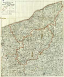
Title: Regierungsbezirke Grenzmark Posen - Westpreußen und Köslin : Maßstab 1:300 000
Subtitle:
Ravensteins Bürokarte ; Nr. 38 a
Publisher:
Ravensteins Geographische Verlagsanstalt u. Druckerei
Place of publishing:
Description:
Scala 1:300 000 ; 1 map : col. ; 99x77 cm, on sheet 98x82cm ; Date of publication connected with political boundary on the map
Relation:
Detailed Resource Type:
Format:
Resource Identifier:
Source:
CBGiOŚ. IGiPZ PAN, call no. D.2907 [m.polit.-adm.76] ; click here to follow the link
Language:
Rights:
Terms of use:
Digitizing institution:
Institute of Geography and Spatial Organization of the Polish Academy of Sciences
Original in:
Projects co-financed by:
Programme Innovative Economy, 2010-2014, Priority Axis 2. R&D infrastructure ; European Union. European Regional Development Fund
Access:
Object collections:
- Digital Repository of Scientific Institutes > Partners' collections > Institute of Geography and Spatial Organization PAS (IGiPZ PAN) > Library
- Digital Repository of Scientific Institutes > Partners' collections > Institute of Geography and Spatial Organization PAS (IGiPZ PAN) > Library > Maps and atlases
- Digital Repository of Scientific Institutes > Literature > Maps/Atlases
Last modified:
Oct 2, 2020
In our library since:
Jun 28, 2013
Number of object content downloads / hits:
274
All available object's versions:
https://rcin.org.pl./publication/38500
Show description in RDF format:
Show description in RDFa format:
Show description in OAI-PMH format:
| Edition name | Date |
|---|---|
| Regierungsbezirke Grenzmark Posen - Westpreußen und Köslin : Maßstab 1:300 000, [ante 1939] | Oct 2, 2020 |

 INSTYTUT ARCHEOLOGII I ETNOLOGII POLSKIEJ AKADEMII NAUK
 INSTYTUT BADAŃ LITERACKICH POLSKIEJ AKADEMII NAUK
 INSTYTUT BADAWCZY LEŚNICTWA
 INSTYTUT BIOLOGII DOŚWIADCZALNEJ IM. MARCELEGO NENCKIEGO POLSKIEJ AKADEMII NAUK
 INSTYTUT BIOLOGII SSAKÓW POLSKIEJ AKADEMII NAUK
 INSTYTUT CHEMII FIZYCZNEJ PAN
 INSTYTUT CHEMII ORGANICZNEJ PAN
 INSTYTUT FILOZOFII I SOCJOLOGII PAN
 INSTYTUT GEOGRAFII I PRZESTRZENNEGO ZAGOSPODAROWANIA PAN
 INSTYTUT HISTORII im. TADEUSZA MANTEUFFLA POLSKIEJ AKADEMII NAUK
 INSTYTUT JĘZYKA POLSKIEGO POLSKIEJ AKADEMII NAUK
 INSTYTUT MATEMATYCZNY PAN
 INSTYTUT MEDYCYNY DOŚWIADCZALNEJ I KLINICZNEJ IM.MIROSŁAWA MOSSAKOWSKIEGO POLSKIEJ AKADEMII NAUK
 INSTYTUT PODSTAWOWYCH PROBLEMÓW TECHNIKI PAN
 INSTYTUT SLAWISTYKI PAN
 SIEĆ BADAWCZA ŁUKASIEWICZ - INSTYTUT TECHNOLOGII MATERIAŁÓW ELEKTRONICZNYCH
 MUZEUM I INSTYTUT ZOOLOGII POLSKIEJ AKADEMII NAUK
 INSTYTUT BADAŃ SYSTEMOWYCH PAN
 INSTYTUT BOTANIKI IM. WŁADYSŁAWA SZAFERA POLSKIEJ AKADEMII NAUK


