- Search in all Repository
- Literature and maps
- Archeology
- Mills database
- Natural sciences
Advanced search
Advanced search
Advanced search
Advanced search
Advanced search

Object
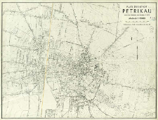
Title: Plan der Stadt Petrikau : nach dem Stadtplan von Petrikau 1:5 000
Publisher:
Ie. Kart.-Druck.- Abt. (mot) 530
Place of publishing:
Description:
Scale 1:10 000 ; 1 map ; 33x43 cm, on sheet 35x45 cm
Detailed Resource Type:
Format:
File size 3,5 MB ; image/x.djvu
Resource Identifier:
Source:
CBGiOŚ. IGiPZ PAN, call no. PTG D.778 pl.m.68 ; click here to follow the link
Language:
Rights:
Terms of use:
Digitizing institution:
Institute of Geography and Spatial Organization of the Polish Academy of Sciences
Original in:
Projects co-financed by:
Programme Innovative Economy, 2010-2014, Priority Axis 2. R&D infrastructure ; European Union. European Regional Development Fund
Access:
Object collections:
- Digital Repository of Scientific Institutes > Partners' collections > Institute of Geography and Spatial Organization PAS (IGiPZ PAN) > Library
- Digital Repository of Scientific Institutes > Partners' collections > Institute of Geography and Spatial Organization PAS (IGiPZ PAN) > Library > Maps and atlases
- Digital Repository of Scientific Institutes > Partners' collections > Institute of Geography and Spatial Organization PAS (IGiPZ PAN) > Library > Selected collections > Polish Geographical Society Collection
- Digital Repository of Scientific Institutes > Literature > Maps/Atlases
Last modified:
Dec 2, 2020
In our library since:
Sep 11, 2012
Number of object content downloads / hits:
631
All available object's versions:
https://rcin.org.pl./publication/25142
Show description in RDF format:
Show description in RDFa format:
Show description in OAI-PMH format:
| Edition name | Date |
|---|---|
| Plan der Stadt Petrikau : nach dem Stadtplan von Petrikau 1:5 000, [ca 1941] | Dec 2, 2020 |
Objects Similar
Niemcy. Heer. Karten-Druckerei-Abteilung 530.
Niemcy. Heer. Karten-Druckerei-Abteilung 530.
Niemcy. Heer. Karten-Druckerei-Abteilung 530.
Niemcy. Heer. Karten-Druckerei-Abteilung (530). Drukarz
Kaiserlich-Königliches Militär-Geographisches Institut (Wiedeń). Instytucja sprawcza. Wydawca
Rosja. Armiâ. Glavnyj štab. Litografìâ kartografičeskago zavedenìâ. Wydawca Rosja. Armiâ. Glavnyj štab. Voenno-topografičeskij otdel. Instytucja sprawcza
Flek, G. Rys. Valinskij Kržeminskij
Rosja. Armiâ. Glavnyj štab. Voenno-topografičeskij otdel Rosja. Armiâ. Glavnyj štab. Litografìâ kartografičeskago zavedenìâ

 INSTYTUT ARCHEOLOGII I ETNOLOGII POLSKIEJ AKADEMII NAUK
 INSTYTUT BADAŃ LITERACKICH POLSKIEJ AKADEMII NAUK
 INSTYTUT BADAWCZY LEŚNICTWA
 INSTYTUT BIOLOGII DOŚWIADCZALNEJ IM. MARCELEGO NENCKIEGO POLSKIEJ AKADEMII NAUK
 INSTYTUT BIOLOGII SSAKÓW POLSKIEJ AKADEMII NAUK
 INSTYTUT CHEMII FIZYCZNEJ PAN
 INSTYTUT CHEMII ORGANICZNEJ PAN
 INSTYTUT FILOZOFII I SOCJOLOGII PAN
 INSTYTUT GEOGRAFII I PRZESTRZENNEGO ZAGOSPODAROWANIA PAN
 INSTYTUT HISTORII im. TADEUSZA MANTEUFFLA POLSKIEJ AKADEMII NAUK
 INSTYTUT JĘZYKA POLSKIEGO POLSKIEJ AKADEMII NAUK
 INSTYTUT MATEMATYCZNY PAN
 INSTYTUT MEDYCYNY DOŚWIADCZALNEJ I KLINICZNEJ IM.MIROSŁAWA MOSSAKOWSKIEGO POLSKIEJ AKADEMII NAUK
 INSTYTUT PODSTAWOWYCH PROBLEMÓW TECHNIKI PAN
 INSTYTUT SLAWISTYKI PAN
 SIEĆ BADAWCZA ŁUKASIEWICZ - INSTYTUT TECHNOLOGII MATERIAŁÓW ELEKTRONICZNYCH
 MUZEUM I INSTYTUT ZOOLOGII POLSKIEJ AKADEMII NAUK
 INSTYTUT BADAŃ SYSTEMOWYCH PAN
 INSTYTUT BOTANIKI IM. WŁADYSŁAWA SZAFERA POLSKIEJ AKADEMII NAUK


