- About project
- Collections
- Indexes
- Recently viewed
-
RCIN Repositories
-
 INSTYTUT ARCHEOLOGII I ETNOLOGII POLSKIEJ AKADEMII NAUK
-
 INSTYTUT BADAŃ LITERACKICH POLSKIEJ AKADEMII NAUK
-
 INSTYTUT BADAWCZY LEŚNICTWA
-
 INSTYTUT BIOLOGII DOŚWIADCZALNEJ IM. MARCELEGO NENCKIEGO POLSKIEJ AKADEMII NAUK
-
 INSTYTUT BIOLOGII SSAKÓW POLSKIEJ AKADEMII NAUK
-
 INSTYTUT CHEMII FIZYCZNEJ PAN
-
 INSTYTUT CHEMII ORGANICZNEJ PAN
-
 INSTYTUT FILOZOFII I SOCJOLOGII PAN
-
 INSTYTUT GEOGRAFII I PRZESTRZENNEGO ZAGOSPODAROWANIA PAN
-
 INSTYTUT HISTORII im. TADEUSZA MANTEUFFLA POLSKIEJ AKADEMII NAUK
-
 INSTYTUT JĘZYKA POLSKIEGO POLSKIEJ AKADEMII NAUK
-
 INSTYTUT MATEMATYCZNY PAN
-
 INSTYTUT MEDYCYNY DOŚWIADCZALNEJ I KLINICZNEJ IM.MIROSŁAWA MOSSAKOWSKIEGO POLSKIEJ AKADEMII NAUK
-
 INSTYTUT PODSTAWOWYCH PROBLEMÓW TECHNIKI PAN
-
 INSTYTUT SLAWISTYKI PAN
-
 SIEĆ BADAWCZA ŁUKASIEWICZ - INSTYTUT TECHNOLOGII MATERIAŁÓW ELEKTRONICZNYCH
-
 MUZEUM I INSTYTUT ZOOLOGII POLSKIEJ AKADEMII NAUK
-
 INSTYTUT BADAŃ SYSTEMOWYCH PAN
-
 INSTYTUT BOTANIKI IM. WŁADYSŁAWA SZAFERA POLSKIEJ AKADEMII NAUK
-

Object
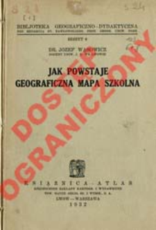
Title: Jak powstaje geograficzna mapa szkolna
Subtitle:
Bibljoteka Geograficzno-Dydaktyczna ; z. 6
Publisher:
Place of publishing:
Description:
35 s. : il. ; 20 cm ; Bibliogr. s. [36]
Type of object:
Relation:
Biblioteka Geograficzno-Dydaktyczna
Detailed Resource Type:
Format:
Rozmiar pliku 8,7 MB ; application/pdf
Resource Identifier:
Source:
CBGiOŚ. IGiPZ PAN, sygn. S.24[6] ; click here to follow the link
Language:
Rights:
Prawa zastrzeżone - dostęp ograniczony
Terms of use:
Digitizing institution:
Instytut Geografii i Przestrzennego Zagospodarowania Polskiej Akademii Nauk
Original in:
Projects co-financed by:
Program Operacyjny Innowacyjna Gospodarka, lata 2010-2014, Priorytet 2. Infrastruktura strefy B + R ; Unia Europejska. Europejski Fundusz Rozwoju Regionalnego
Access:
Object collections:
- Digital Repository of Scientific Institutes > Partners' collections > Institute of Geography and Spatial Organization PAS (IGiPZ PAN) > Library > Books
- Digital Repository of Scientific Institutes > Partners' collections > Institute of Geography and Spatial Organization PAS (IGiPZ PAN) > Library > Series/Journals/Periodics
- Digital Repository of Scientific Institutes > Literature > Books/Chapters
Last modified:
Oct 2, 2020
In our library since:
Dec 6, 2012
Number of object content downloads / hits:
106
All available object's versions:
https://rcin.org.pl./publication/24164
Show description in RDF format:
Show description in RDFa format:
Show description in OAI-PMH format:
| Edition name | Date |
|---|---|
| z. 6 (1932) : Jak powstaje geograficzna mapa szkolna | Oct 2, 2020 |
Objects Similar
Stefaniak, Arleta
Romer, Eugeniusz (1871–1954) Wąsowicz, Józef (1900–1964) Instytut Kartograficzny im. Eugeniusza Romera
Kiełczewska-Zaleska, Maria (1906–1980)
Szumański, Teofil
Romer, Eugeniusz (1871–1954) Wąsowicz, Józef (1900–1964) Instytut Kartograficzny im. Eugeniusza Romera Zjednoczone Zakłady Kartograficzne i Wydawnicze Towarzystwa Nauczycieli Szkół Wyższych Książnica-Atlas (Wrocław)
Romer, Eugeniusz (1871–1954) Wąsowicz, Józef (1900–1964) Instytut Kartograficzny im. Eugeniusza Romera Zjednoczone Zakłady Kartograficzne i Wydawnicze Towarzystwa Nauczycieli Szkół Wyższych Książnica-Atlas (Wrocław)


