- Search in all Repository
- Literature and maps
- Archeology
- Mills database
- Natural sciences
Advanced search
Advanced search
Advanced search
Advanced search
Advanced search

Object
Available formats:
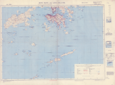
Download allTitle: Hong Kong and the Lema Island : south sheet : scale 1:80,000
Institutional creator:
Publisher:
Place of publishing:
Description:
Third Edition ; Skala 1:80 000 ; 1 mapa : kolorowa ; 90 x 68 cm, na arkuszu 75 x 101 cm ; Nad ramką mapy adnotacja: Refer to this map as G.S.G.S. 3961 Hong Kong. South Sheet Third Edition. Na dolnym marginesie informacje: Geographical Section, General Staff, No. 3961; Published by the War Office, 1938. 3rd. Edition (Grid Correction) 1946; Communication and main Topographical details checked by I.S.T.D.; Reprinted from HIND 1015, Mar. 1946 Edition, by War Office 1949
Detailed Resource Type:
Resource Identifier:
Source:
CBGiOŚ. IGiPZ PAN, sygn. PTG C.118/2 ; click here to follow the link
Language:
Coverage:
Rights:
Terms of use:
Digitizing institution:
Instytut Geografii i Przestrzennego Zagospodarowania Polskiej Akademii Nauk
Original in:
Projects co-financed by:
Access:
Object collections:
- Digital Repository of Scientific Institutes > Partners' collections > Institute of Geography and Spatial Organization PAS (IGiPZ PAN) > Library > Maps and atlases
- Digital Repository of Scientific Institutes > Partners' collections > Institute of Geography and Spatial Organization PAS (IGiPZ PAN) > Library > Selected collections > Polish Geographical Society Collection
- Digital Repository of Scientific Institutes > Literature > Maps/Atlases
Last modified:
Oct 20, 2021
In our library since:
Oct 20, 2021
Number of object content downloads / hits:
50
All available object's versions:
https://rcin.org.pl./publication/226434
Show description in RDF format:
Show description in RDFa format:
Show description in OAI-PMH format:
| Edition name | Date |
|---|---|
| Hong Kong and the Lema Island : south sheet : scale 1:80,000, 1949 | Oct 20, 2021 |
Objects Similar
Związek Radziecki. Vooružennye Sily. Generalʹnyj štab.
Bawaria (Niemcy ; land). Topographisches Bureau. Redaktor Niemcy. Hauptvermessungsabteilung XIII. Wydawca
Wirtembergia (Niemcy). Ministerium des Innern. Hauptvermessungsabteilung XII. Redaktor
Niemcy. Reichsamt für Landesaufnahme. Redaktor Prusy. Landesaufnahme. Redaktor Hesja (Niemcy ; land). Landesvermessungsamt. Redaktor. Wydawca
Niemcy. Reichsamt für Landesaufnahme. Redaktor Prusy. Landesaufnahme. Redaktor Hesja (Niemcy ; land). Landesvermessungsamt. Redaktor. Wydawca

 INSTYTUT ARCHEOLOGII I ETNOLOGII POLSKIEJ AKADEMII NAUK
 INSTYTUT BADAŃ LITERACKICH POLSKIEJ AKADEMII NAUK
 INSTYTUT BADAWCZY LEŚNICTWA
 INSTYTUT BIOLOGII DOŚWIADCZALNEJ IM. MARCELEGO NENCKIEGO POLSKIEJ AKADEMII NAUK
 INSTYTUT BIOLOGII SSAKÓW POLSKIEJ AKADEMII NAUK
 INSTYTUT CHEMII FIZYCZNEJ PAN
 INSTYTUT CHEMII ORGANICZNEJ PAN
 INSTYTUT FILOZOFII I SOCJOLOGII PAN
 INSTYTUT GEOGRAFII I PRZESTRZENNEGO ZAGOSPODAROWANIA PAN
 INSTYTUT HISTORII im. TADEUSZA MANTEUFFLA POLSKIEJ AKADEMII NAUK
 INSTYTUT JĘZYKA POLSKIEGO POLSKIEJ AKADEMII NAUK
 INSTYTUT MATEMATYCZNY PAN
 INSTYTUT MEDYCYNY DOŚWIADCZALNEJ I KLINICZNEJ IM.MIROSŁAWA MOSSAKOWSKIEGO POLSKIEJ AKADEMII NAUK
 INSTYTUT PODSTAWOWYCH PROBLEMÓW TECHNIKI PAN
 INSTYTUT SLAWISTYKI PAN
 SIEĆ BADAWCZA ŁUKASIEWICZ - INSTYTUT TECHNOLOGII MATERIAŁÓW ELEKTRONICZNYCH
 MUZEUM I INSTYTUT ZOOLOGII POLSKIEJ AKADEMII NAUK
 INSTYTUT BADAŃ SYSTEMOWYCH PAN
 INSTYTUT BOTANIKI IM. WŁADYSŁAWA SZAFERA POLSKIEJ AKADEMII NAUK


