- Search in all Repository
- Literature and maps
- Archeology
- Mills database
- Natural sciences
Advanced search
Advanced search
Advanced search
Advanced search
Advanced search

Object
Available formats:
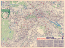
Download allTitle: Olympia 1936 : Plan von Berlin
Subtitle:
Plan von Berlin ; Map of Berlin ; Plano de Berlin ; Dresdner Bank : Plan von Berlin = Map of Berlin = Plan de Berlin = Plano de Berlin
Institutional creator:
Georg-Westermann-Verlag ; Dresdner Bank
Publisher:
Georg Westermann ; [Dresdner Bank]
Place of publishing:
Description:
Skala 1:25 000 ; 1 mapa : kolorowa ; 58 x 79 cm, na arkuszu 61 x 81 cm, złożona 21 x 11 cm ; Tytuł z panela. U dołu adnotacja: Den Besuchern der Olympischen Spiele gewidment = Dedicated to the visitors of the Olympic Games = Dédié aux visiteurs des Jeux Olympiques = Dedicado a los visitadores de los Juegos Olímpicos ; Na odwrocie arkusza mapy poboczne: Das Reichssportfeld, 20 x 18 cm ; Das Stadion mit Platzanordnung, 20 x 20 cm ; Das Olympische Dorf, 20 x 18 cm ; Verkehrsverbindungen zum Reichssportfeld, 20 x 18 cm ; Der Marathonlauf und 50-km-Gehen, 19 x 18 cm ; Regattastrecke in Grünau, 19 x 19 cm ; Segelbahnen auf der Kieler Förde, 19 x 18 cm ; Winterkampfspiele in Garmisch-Partenkirchen, 19 x 18 cm
Detailed Resource Type:
Resource Identifier:
Source:
CBGiOŚ. IGiPZ PAN, sygn. D.6431 ; click here to follow the link
Language:
Rights:
Terms of use:
Digitizing institution:
Instytut Geografii i Przestrzennego Zagospodarowania Polskiej Akademii Nauk
Original in:
Projects co-financed by:
Access:
Object collections:
- Digital Repository of Scientific Institutes > Partners' collections > Institute of Geography and Spatial Organization PAS (IGiPZ PAN)
- Digital Repository of Scientific Institutes > Partners' collections > Institute of Geography and Spatial Organization PAS (IGiPZ PAN) > Library > Maps and atlases
- Digital Repository of Scientific Institutes > Literature > Maps/Atlases
Last modified:
Sep 21, 2021
In our library since:
Sep 17, 2021
Number of object content downloads / hits:
158
All available object's versions:
https://rcin.org.pl./publication/207169
Show description in RDF format:
Show description in RDFa format:
Show description in OAI-PMH format:
| Edition name | Date |
|---|---|
| Olympia 1936 : Plan von Berlin, 1936 | Sep 21, 2021 |
Objects Similar
Wolff, F. G. Nicolai, Friedrich (1733–1811)
Berlin (Niemcy). Statistisches Amt. Wydawca
Prusy. Landesaufnahme. Redaktor Wydawca
Niemcy. Reichsamt für Landesaufnahme. Wydawca Prusy. Landesaufnahme. Redaktor
Stany Zjednoczone. Army Map Service. Wydawca

 INSTYTUT ARCHEOLOGII I ETNOLOGII POLSKIEJ AKADEMII NAUK
 INSTYTUT BADAŃ LITERACKICH POLSKIEJ AKADEMII NAUK
 INSTYTUT BADAWCZY LEŚNICTWA
 INSTYTUT BIOLOGII DOŚWIADCZALNEJ IM. MARCELEGO NENCKIEGO POLSKIEJ AKADEMII NAUK
 INSTYTUT BIOLOGII SSAKÓW POLSKIEJ AKADEMII NAUK
 INSTYTUT CHEMII FIZYCZNEJ PAN
 INSTYTUT CHEMII ORGANICZNEJ PAN
 INSTYTUT FILOZOFII I SOCJOLOGII PAN
 INSTYTUT GEOGRAFII I PRZESTRZENNEGO ZAGOSPODAROWANIA PAN
 INSTYTUT HISTORII im. TADEUSZA MANTEUFFLA POLSKIEJ AKADEMII NAUK
 INSTYTUT JĘZYKA POLSKIEGO POLSKIEJ AKADEMII NAUK
 INSTYTUT MATEMATYCZNY PAN
 INSTYTUT MEDYCYNY DOŚWIADCZALNEJ I KLINICZNEJ IM.MIROSŁAWA MOSSAKOWSKIEGO POLSKIEJ AKADEMII NAUK
 INSTYTUT PODSTAWOWYCH PROBLEMÓW TECHNIKI PAN
 INSTYTUT SLAWISTYKI PAN
 SIEĆ BADAWCZA ŁUKASIEWICZ - INSTYTUT TECHNOLOGII MATERIAŁÓW ELEKTRONICZNYCH
 MUZEUM I INSTYTUT ZOOLOGII POLSKIEJ AKADEMII NAUK
 INSTYTUT BADAŃ SYSTEMOWYCH PAN
 INSTYTUT BOTANIKI IM. WŁADYSŁAWA SZAFERA POLSKIEJ AKADEMII NAUK


