- Search in all Repository
- Literature and maps
- Archeology
- Mills database
- Natural sciences
Advanced search
Advanced search
Advanced search
Advanced search
Advanced search

Object
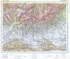
Title: Pas 52 Słup 30 Tatry Wysokie
Subtitle:
Publisher:
Wojskowy Instytut Geograficzny
Place of publishing:
Description:
Scale 1:100 000 ; 1 map : col. ; 29x38 cm
Relation:
Mapa taktyczna Polski 1:100 000
Detailed Resource Type:
Format:
Resource Identifier:
Source:
CBGiOŚ. IGiPZ PAN, call no. C.626/386
Language:
Rights:
Terms of use:
Digitizing institution:
Institute of Geography and Spatial Organization of the Polish Academy of Sciences
Original in:
Access:
Object collections:
- Digital Repository of Scientific Institutes > Partners' collections > Institute of Geography and Spatial Organization PAS (IGiPZ PAN) > Library > Maps and atlases
- Digital Repository of Scientific Institutes > Literature > Maps/Atlases
Last modified:
Oct 2, 2020
In our library since:
Jul 24, 2009
Number of object content downloads / hits:
23 845
All available object's versions:
https://rcin.org.pl./publication/198
Show description in RDF format:
Show description in RDFa format:
Show description in OAI-PMH format:
| Edition name | Date |
|---|---|
| Pas 52 Słup 30 Tatry Wysokie | Oct 2, 2020 |
Objects Similar
Polska. Wojsko Polskie (1918 - 1939). Sztab Generalny. Instytucja sprawcza. Wydawca Wojskowe Zakłady Kartograficzne. Drukarz
Zwoliński, Tadeusz (1893–1955)
Dokaupil, Roman (18...- 19...). Redaktor Straka, J. Redaktor Bloschitz, Rudolf Macoun, V. Redaktor
Putschi, R. Redaktor Nikel, H. L. Redaktor Kaiserlich-Königliches Militär-Geographisches Institut (Wiedeń). Instytucja sprawcza Wydawca
Leitner, G. Redaktor Storch, A. (18..-19..). Redaktor Kaiserlich-Königliches Militär-Geographisches Institut (Wiedeń). Instytucja sprawcza Wydawca
Wojskowy Instytut Geograficzny (Warszawa). Wydawca. Drukarz
Niemcy. Grosser Generalstab. Kartographische Abteilung. Redaktor

 INSTYTUT ARCHEOLOGII I ETNOLOGII POLSKIEJ AKADEMII NAUK
 INSTYTUT BADAŃ LITERACKICH POLSKIEJ AKADEMII NAUK
 INSTYTUT BADAWCZY LEŚNICTWA
 INSTYTUT BIOLOGII DOŚWIADCZALNEJ IM. MARCELEGO NENCKIEGO POLSKIEJ AKADEMII NAUK
 INSTYTUT BIOLOGII SSAKÓW POLSKIEJ AKADEMII NAUK
 INSTYTUT CHEMII FIZYCZNEJ PAN
 INSTYTUT CHEMII ORGANICZNEJ PAN
 INSTYTUT FILOZOFII I SOCJOLOGII PAN
 INSTYTUT GEOGRAFII I PRZESTRZENNEGO ZAGOSPODAROWANIA PAN
 INSTYTUT HISTORII im. TADEUSZA MANTEUFFLA POLSKIEJ AKADEMII NAUK
 INSTYTUT JĘZYKA POLSKIEGO POLSKIEJ AKADEMII NAUK
 INSTYTUT MATEMATYCZNY PAN
 INSTYTUT MEDYCYNY DOŚWIADCZALNEJ I KLINICZNEJ IM.MIROSŁAWA MOSSAKOWSKIEGO POLSKIEJ AKADEMII NAUK
 INSTYTUT PODSTAWOWYCH PROBLEMÓW TECHNIKI PAN
 INSTYTUT SLAWISTYKI PAN
 SIEĆ BADAWCZA ŁUKASIEWICZ - INSTYTUT TECHNOLOGII MATERIAŁÓW ELEKTRONICZNYCH
 MUZEUM I INSTYTUT ZOOLOGII POLSKIEJ AKADEMII NAUK
 INSTYTUT BADAŃ SYSTEMOWYCH PAN
 INSTYTUT BOTANIKI IM. WŁADYSŁAWA SZAFERA POLSKIEJ AKADEMII NAUK


