- Search in all Repository
- Literature and maps
- Archeology
- Mills database
- Natural sciences
Advanced search
Advanced search
Advanced search
Advanced search
Advanced search

Object
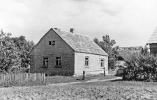
Brick wall
Resource type:
Name:
Other names:
Type of object:
Location- administrative unit (present):
Konopki, Grajewo commune, Grajewo district, podlaskie voivodeship (Poland)
Location- administrative unit (former):
Konopki, Grajewo county, białostockie voivodeship
Topographic location:
53° 39′ 11.16″ N, 22° 24′ 32.08″ E
See the map:
Object description:
In the photo there is a brick wall.
Author (of drawing, photo, record):
Data:
Accession number:
General remarks:
Photo negative no F 208/57/20/P 23 (31-32)
Relation:
Detailed Resource Type:
Resource Identifier:
Rights:
Terms of use:
Digitizing institution:
Institute of Archaeology and Ethnology of the Polish Academy of Sciences
Original in:
Institute of Archaeology and Ethnology of the Polish Academy of Sciences
Projects co-financed by:
Operational Program Digital Poland, 2014-2020, Measure 2.3: Digital accessibility and usefulness of public sector information; funds from the European Regional Development Fund and national co-financing from the state budget. ; European Union. European Regional Development Fund
Access:
Object collections:
- Digital Repository of Scientific Institutes > Partners' collections > Institute of Archeology and Ethnology PAS > Ethnographical Archive > Polish Ethnographic Atlas
- Digital Repository of Scientific Institutes > Scientific data and objects > Humanities and Social Sciences > Collections in the field of cultural anthropology
Last modified:
Oct 27, 2022
In our library since:
Feb 10, 2021
Number of object content downloads / hits:
9
All available object's versions:
https://rcin.org.pl./publication/194204
Show description in RDF format:
Show description in RDFa format:
Show description in OAI-PMH format:
| Edition name | Date |
|---|---|
| Ściana ceglana | Oct 27, 2022 |

 INSTYTUT ARCHEOLOGII I ETNOLOGII POLSKIEJ AKADEMII NAUK
 INSTYTUT BADAŃ LITERACKICH POLSKIEJ AKADEMII NAUK
 INSTYTUT BADAWCZY LEŚNICTWA
 INSTYTUT BIOLOGII DOŚWIADCZALNEJ IM. MARCELEGO NENCKIEGO POLSKIEJ AKADEMII NAUK
 INSTYTUT BIOLOGII SSAKÓW POLSKIEJ AKADEMII NAUK
 INSTYTUT CHEMII FIZYCZNEJ PAN
 INSTYTUT CHEMII ORGANICZNEJ PAN
 INSTYTUT FILOZOFII I SOCJOLOGII PAN
 INSTYTUT GEOGRAFII I PRZESTRZENNEGO ZAGOSPODAROWANIA PAN
 INSTYTUT HISTORII im. TADEUSZA MANTEUFFLA POLSKIEJ AKADEMII NAUK
 INSTYTUT JĘZYKA POLSKIEGO POLSKIEJ AKADEMII NAUK
 INSTYTUT MATEMATYCZNY PAN
 INSTYTUT MEDYCYNY DOŚWIADCZALNEJ I KLINICZNEJ IM.MIROSŁAWA MOSSAKOWSKIEGO POLSKIEJ AKADEMII NAUK
 INSTYTUT PODSTAWOWYCH PROBLEMÓW TECHNIKI PAN
 INSTYTUT SLAWISTYKI PAN
 SIEĆ BADAWCZA ŁUKASIEWICZ - INSTYTUT TECHNOLOGII MATERIAŁÓW ELEKTRONICZNYCH
 MUZEUM I INSTYTUT ZOOLOGII POLSKIEJ AKADEMII NAUK
 INSTYTUT BADAŃ SYSTEMOWYCH PAN
 INSTYTUT BOTANIKI IM. WŁADYSŁAWA SZAFERA POLSKIEJ AKADEMII NAUK


