- Search in all Repository
- Literature and maps
- Archeology
- Mills database
- Natural sciences
Advanced search
Advanced search
Advanced search
Advanced search
Advanced search

Object
Available formats:
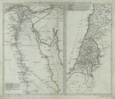
Download allTitle: Succincta Antiquioris Ægypti et Palæstinæ delineacio
Subtitle:
Ancienne Egypte et l'ancienne Palestine ; Alt Ægypten und Palæstina ; Succincta Antiquioris Aegypti et Palaestinae delineacio ; Alt Aegypten und Palaestina
Institutional creator:
Königliche Akademie der Wissenschaften.
Publisher:
Auspiciis Acad. Reg. Scient. et Eleg. Litt.
Place of publishing:
Description:
Scale [ca 1:1 900 000] ; Scale [ca 1:2 800 000] ; 2 maps on 1 sheet : copperplate engraving, hand colored ; 22x33 cm, 17x33 cm ; Ferro's prime meridian determined by the cataloger ; The map of Egypt has four linear scales, and the map of Palestine has five linear scales ; Place and date of publication according to information from the biography of J. C. Rhode in: Tooley's dictionary of mapmakers. - Riverside, 2004 ; Title in Latin, French and German
Type of object:
Detailed Resource Type:
Resource Identifier:
Source:
CBGiOŚ. IGiPZ PAN, call no. PTG B.853[6] ; click here to follow the link
Language:
Coverage:
(E 34°10'-E 37°30'/N 35°10'-N 30°).
![]()
Rights:
Terms of use:
Digitizing institution:
Institute of Geography and Spatial Organization of the Polish Academy of Sciences
Original in:
Projects co-financed by:
Access:
Object collections:
- Digital Repository of Scientific Institutes > Partners' collections > Institute of Geography and Spatial Organization PAS (IGiPZ PAN) > Library
- Digital Repository of Scientific Institutes > Partners' collections > Institute of Geography and Spatial Organization PAS (IGiPZ PAN) > Library > Maps and atlases
- Digital Repository of Scientific Institutes > Partners' collections > Institute of Geography and Spatial Organization PAS (IGiPZ PAN) > Library > Selected collections
- Digital Repository of Scientific Institutes > Partners' collections > Institute of Geography and Spatial Organization PAS (IGiPZ PAN) > Library > Selected collections > Polish Geographical Society Collection
- Digital Repository of Scientific Institutes > Literature > Maps/Atlases
Last modified:
Apr 14, 2021
In our library since:
Apr 14, 2021
Number of object content downloads / hits:
47
All available object's versions:
https://rcin.org.pl./publication/193755
Show description in RDF format:
Show description in RDFa format:
Show description in OAI-PMH format:
| Edition name | Date |
|---|---|
| Rhode, Johann Christoph (1713 - 1786), [ca 1772], Succincta Antiquioris Ægypti et Palæstinæ delineacio | Apr 14, 2021 |
Objects Similar
Harenberg, Johann Christoph (1696–1774)
Harenberg, Johann Christoph (1696–1774)

 INSTYTUT ARCHEOLOGII I ETNOLOGII POLSKIEJ AKADEMII NAUK
 INSTYTUT BADAŃ LITERACKICH POLSKIEJ AKADEMII NAUK
 INSTYTUT BADAWCZY LEŚNICTWA
 INSTYTUT BIOLOGII DOŚWIADCZALNEJ IM. MARCELEGO NENCKIEGO POLSKIEJ AKADEMII NAUK
 INSTYTUT BIOLOGII SSAKÓW POLSKIEJ AKADEMII NAUK
 INSTYTUT CHEMII FIZYCZNEJ PAN
 INSTYTUT CHEMII ORGANICZNEJ PAN
 INSTYTUT FILOZOFII I SOCJOLOGII PAN
 INSTYTUT GEOGRAFII I PRZESTRZENNEGO ZAGOSPODAROWANIA PAN
 INSTYTUT HISTORII im. TADEUSZA MANTEUFFLA POLSKIEJ AKADEMII NAUK
 INSTYTUT JĘZYKA POLSKIEGO POLSKIEJ AKADEMII NAUK
 INSTYTUT MATEMATYCZNY PAN
 INSTYTUT MEDYCYNY DOŚWIADCZALNEJ I KLINICZNEJ IM.MIROSŁAWA MOSSAKOWSKIEGO POLSKIEJ AKADEMII NAUK
 INSTYTUT PODSTAWOWYCH PROBLEMÓW TECHNIKI PAN
 INSTYTUT SLAWISTYKI PAN
 SIEĆ BADAWCZA ŁUKASIEWICZ - INSTYTUT TECHNOLOGII MATERIAŁÓW ELEKTRONICZNYCH
 MUZEUM I INSTYTUT ZOOLOGII POLSKIEJ AKADEMII NAUK
 INSTYTUT BADAŃ SYSTEMOWYCH PAN
 INSTYTUT BOTANIKI IM. WŁADYSŁAWA SZAFERA POLSKIEJ AKADEMII NAUK


