- Search in all Repository
- Literature and maps
- Archeology
- Mills database
- Natural sciences
Advanced search
Advanced search
Advanced search
Advanced search
Advanced search

Object
Available formats:
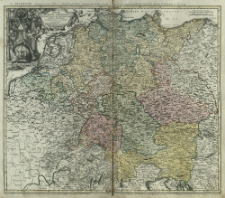
Download allTitle: Imperii Romano-Germanici in Svos Statvs et Circvlos Divisi Tabvla Generalis
Creator:
Homann, Johann Baptist (1664–1724) ; Hauer, Daniel Adam : Ryt. (1734-około 1789) ; Schatz, Johann Jakob (1691–1760) : Oprac.
Date issued/created:
Resource type:
Subtitle:
Imperii Romano-Germanici in Suos Status et Circulos Divisi Tabula Generalis ; Allemagne, distinguée en ses Cercles subdivisée en ses Etats
Institutional creator:
Publisher:
Place of publishing:
Description:
Scale [ca 1:2 500 000] ; 1 map : copperplate engraving, hand colored ; 45x52 cm ; Ferro meridian, determined after the coordinates have been calculated by the cataloger ; Title from the cartouche. Above the frame: L'Allemagne, distinguée en ses Cercles subdivisée en ses Etat contenant son Etendu epresente, rectifiée & methodiquement enluminée suivant les Elements de Geographie de Mr. Schatz ; The earlier edition of the map comes from 1741. The version of the map with the engraver's name in the lower right corner of the sheet between the map frames ; Title in Latin and French, explanatory text below the map frame in French
Type of object:
Detailed Resource Type:
Resource Identifier:
Source:
CBGiOŚ. IGiPZ PAN, call no. B.1693[5] ; click here to follow the link
Language:
Coverage:
Rights:
Terms of use:
Digitizing institution:
Institute of Geography and Spatial Organization of the Polish Academy of Sciences
Original in:
Projects co-financed by:
Access:
Object collections:
- Digital Repository of Scientific Institutes > Partners' collections > Institute of Geography and Spatial Organization PAS (IGiPZ PAN) > Library
- Digital Repository of Scientific Institutes > Partners' collections > Institute of Geography and Spatial Organization PAS (IGiPZ PAN) > Library > Maps and atlases
- Digital Repository of Scientific Institutes > Literature > Maps/Atlases
Last modified:
Mar 29, 2021
In our library since:
Mar 29, 2021
Number of object content downloads / hits:
40
All available object's versions:
https://rcin.org.pl./publication/193193
Show description in RDF format:
Show description in RDFa format:
Show description in OAI-PMH format:
Objects Similar
Homann, Johann Baptist (1664–1724)
Homann, Johann Baptist (1664–1724)
Homann, Johann Baptist (1664–1724)
Homann, Johann Baptist (1664–1724)
Homann, Johann Baptist (1664–1724)
Homann, Johann Baptist (1664–1724)
Homann, Johann Baptist (1664–1724)
Homann, Johann Baptist (1664–1724)

 INSTYTUT ARCHEOLOGII I ETNOLOGII POLSKIEJ AKADEMII NAUK
 INSTYTUT BADAŃ LITERACKICH POLSKIEJ AKADEMII NAUK
 INSTYTUT BADAWCZY LEŚNICTWA
 INSTYTUT BIOLOGII DOŚWIADCZALNEJ IM. MARCELEGO NENCKIEGO POLSKIEJ AKADEMII NAUK
 INSTYTUT BIOLOGII SSAKÓW POLSKIEJ AKADEMII NAUK
 INSTYTUT CHEMII FIZYCZNEJ PAN
 INSTYTUT CHEMII ORGANICZNEJ PAN
 INSTYTUT FILOZOFII I SOCJOLOGII PAN
 INSTYTUT GEOGRAFII I PRZESTRZENNEGO ZAGOSPODAROWANIA PAN
 INSTYTUT HISTORII im. TADEUSZA MANTEUFFLA POLSKIEJ AKADEMII NAUK
 INSTYTUT JĘZYKA POLSKIEGO POLSKIEJ AKADEMII NAUK
 INSTYTUT MATEMATYCZNY PAN
 INSTYTUT MEDYCYNY DOŚWIADCZALNEJ I KLINICZNEJ IM.MIROSŁAWA MOSSAKOWSKIEGO POLSKIEJ AKADEMII NAUK
 INSTYTUT PODSTAWOWYCH PROBLEMÓW TECHNIKI PAN
 INSTYTUT SLAWISTYKI PAN
 SIEĆ BADAWCZA ŁUKASIEWICZ - INSTYTUT TECHNOLOGII MATERIAŁÓW ELEKTRONICZNYCH
 MUZEUM I INSTYTUT ZOOLOGII POLSKIEJ AKADEMII NAUK
 INSTYTUT BADAŃ SYSTEMOWYCH PAN
 INSTYTUT BOTANIKI IM. WŁADYSŁAWA SZAFERA POLSKIEJ AKADEMII NAUK


