- O repozytorium
- Kolekcje
- Indeksy
- Historia przeglądania
-
Repozytoria RCIN
-
 INSTYTUT ARCHEOLOGII I ETNOLOGII POLSKIEJ AKADEMII NAUK
-
 INSTYTUT BADAŃ LITERACKICH POLSKIEJ AKADEMII NAUK
-
 INSTYTUT BADAWCZY LEŚNICTWA
-
 INSTYTUT BIOLOGII DOŚWIADCZALNEJ IM. MARCELEGO NENCKIEGO POLSKIEJ AKADEMII NAUK
-
 INSTYTUT BIOLOGII SSAKÓW POLSKIEJ AKADEMII NAUK
-
 INSTYTUT CHEMII FIZYCZNEJ PAN
-
 INSTYTUT CHEMII ORGANICZNEJ PAN
-
 INSTYTUT FILOZOFII I SOCJOLOGII PAN
-
 INSTYTUT GEOGRAFII I PRZESTRZENNEGO ZAGOSPODAROWANIA PAN
-
 INSTYTUT HISTORII im. TADEUSZA MANTEUFFLA POLSKIEJ AKADEMII NAUK
-
 INSTYTUT JĘZYKA POLSKIEGO POLSKIEJ AKADEMII NAUK
-
 INSTYTUT MATEMATYCZNY PAN
-
 INSTYTUT MEDYCYNY DOŚWIADCZALNEJ I KLINICZNEJ IM.MIROSŁAWA MOSSAKOWSKIEGO POLSKIEJ AKADEMII NAUK
-
 INSTYTUT PODSTAWOWYCH PROBLEMÓW TECHNIKI PAN
-
 INSTYTUT SLAWISTYKI PAN
-
 SIEĆ BADAWCZA ŁUKASIEWICZ - INSTYTUT TECHNOLOGII MATERIAŁÓW ELEKTRONICZNYCH
-
 MUZEUM I INSTYTUT ZOOLOGII POLSKIEJ AKADEMII NAUK
-
 INSTYTUT BADAŃ SYSTEMOWYCH PAN
-
 INSTYTUT BOTANIKI IM. WŁADYSŁAWA SZAFERA POLSKIEJ AKADEMII NAUK
-

Obiekt
Dostępne formaty:
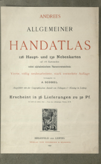
Pobierz wszystkieTytuł: Andrees allgemeiner Handatlas in 126 Haupt- und 137 Nebenkarten : nebst vollständigem alphabetischem Namenverzeichnis
Twórca:
Andree, Richard (1835–1912) ; Scobel, Albert (1851–1912) : Red. ; Geographische Anstalt von Velhagen und Klasing (Lipsk)
Data wydania/powstania:
Typ zasobu:
Wydawca:
Miejsce wydania:
Opis:
4., völlig neubearb. und verm. Aufl. ; Scales differ ; 1 atlas ([4] p., 186 l., 179 p.) : lithogr., maps col. ; 45x30 cm ; Loose-leaves folded in container. Date on added title page and index: 1898 r. Without maps no 63-64 and 111-112 ; Index
Szczegółowy typ zasobu:
Format:
Identyfikator zasobu:
Źródło:
CBGiOŚ. IGiPZ PAN, call no. B.1680 ; kliknij tutaj, żeby przejść
Język:
Prawa:
Zasady wykorzystania:
Digitalizacja:
Institute of Geography and Spatial Organization of the Polish Academy of Sciences
Lokalizacja oryginału:
Dofinansowane ze środków:
Programme Innovative Economy, 2010-2014, Priority Axis 2. R&D infrastructure ; European Union. European Regional Development Fund
Dostęp:
Kolekcje, do których przypisany jest obiekt:
- Repozytorium Cyfrowe Instytutów Naukowych > Kolekcje Partnerów > Instytut Geografii i Przestrzennego Zagospodarowania PAN > Biblioteka Instytutu
- Repozytorium Cyfrowe Instytutów Naukowych > Kolekcje Partnerów > Instytut Geografii i Przestrzennego Zagospodarowania PAN > Biblioteka Instytutu > Mapy i atlasy
- Repozytorium Cyfrowe Instytutów Naukowych > Piśmiennictwo > Mapy/Atlasy
Data ostatniej modyfikacji:
8 sty 2021
Data dodania obiektu:
8 sty 2021
Liczba pobrań / odtworzeń:
227
Wszystkie dostępne wersje tego obiektu:
https://rcin.org.pl./publication/19044
Wyświetl opis w formacie RDF:
Wyświetl opis w formacie RDFa:
Wyświetl opis w formacie OAI-PMH:
| Nazwa wydania | Data |
|---|---|
| Andree, Richard (1835-1912), 1899, Andrees allgemeiner Handatlas in 126 Haupt- und 137 Nebenkarten | 8 sty 2021 |
Obiekty Podobne
Andree, Richard (1835–1912) Geographische Anstalt von Velhagen und Klasing (Lipsk)
Andree, Richard (1835–1912) Geographische Anstalt von Velhagen und Klasing (Lipsk)
Droysen, Gustav (1838–1908) Andree, Richard (1835–1912) Geographische Anstalt von Velhagen und Klasing (Lipsk)
Andree, Richard (1835–1912)
Andree, Richard (1835–1912) Putzger, Friedrich Wilhelm (1849– )
Samborska-Kukuć, Dorota Jaros, Maja Giebułtowski, Jerzy
Andree, Richard (1835–1912) Peschel, Oscar (1825–1875)
Andree, Richard (1835–1912) Scobel, Albert (1851–1912)


