Object
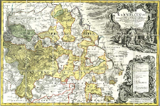
Title: Principatvs Silesiae Karnoviensis nova et exactissima Tabula geographica : commonstrans insimul districtus ac Status minores Freudenthal Olbersdorf et Stevberndorf ; Principatus Silesiae Karnoviensis nova et exactissima Tabula geographica
Creator:
Wieland, Johann Wolfgang (?-1736) ; Schubarth, Mattheus von (1723–1758) ; Homännische Erben
Date issued/created:
Resource type:
Publisher:
ab Haeredibus Homannianis. Cum Spec. S. Caes. R. Mtis. Privil.
Place of publishing:
Description:
Skala [ca 1:94 000] ; 1 mapa : miedzior., kolor. ; 57x84 cm ; Południk zerowy Ferro ; Mapa wydana w 1752 r. w: Atlas Silesiae id est Ducatus Silesiae generaliter [...] ; Cyt. w: Śląsk w dawnej kartografii / Roman Wytyczak, s. 106, poz. 66 ; Cyt. w: Dzikowski. - 1939, s. 257, poz. 191/8
Detailed Resource Type:
Format:
Rozmiar pliku 4,3 MB ; image/x.djvu
Resource Identifier:
Source:
CBGiOŚ. IGiPZ PAN, sygn. D.4842 ; click here to follow the link
Language:
Rights:
Terms of use:
Digitizing institution:
Instytut Geografii i Przestrzennego Zagospodarowania Polskiej Akademii Nauk
Original in:
Projects co-financed by:
Program Operacyjny Innowacyjna Gospodarka, lata 2010-2014, Priorytet 2. Infrastruktura strefy B + R ; Unia Europejska. Europejski Fundusz Rozwoju Regionalnego
Access:
Object collections:
- Digital Repository of Scientific Institutes > Partners' collections > Institute of Geography and Spatial Organization PAS (IGiPZ PAN) > Library
- Digital Repository of Scientific Institutes > Partners' collections > Institute of Geography and Spatial Organization PAS (IGiPZ PAN) > Library > Maps and atlases
- Digital Repository of Scientific Institutes > Literature > Maps/Atlases
Last modified:
Oct 2, 2020
In our library since:
Jul 4, 2012
Number of object content downloads / hits:
190
All available object's versions:
https://rcin.org.pl./publication/18940
Show description in RDF format:
Show description in RDFa format:
Show description in OAI-PMH format:
Objects Similar
Wieland, Johann Wolfgang (?-1736) Schubarth, Mattheus von (1723–1758) Homännische Erben
Wieland, Johann Wolfgang (?-1736) Schubarth, Mattheus von (1723–1758) Homännische Erben
Wieland, Johann Wolfgang (?-1736) Schubarth, Mattheus von (1723–1758) Homännische Erben
Wieland, Johann Wolfgang (?-1736) Schubarth, Mattheus von (1723–1758) Homännische Erben
Wieland, Johann Wolfgang (?-1736) Homännische Erben Schubarth, Mattheus von (1723–1758)
Wieland, Johann Wolfgang (?-1736) Schubarth, Mattheus von (1723–1758) Homännische Erben
Wieland, Johann Wolfgang (?-1736) Schubarth, Mattheus von (1723–1758) Homännische Erben
Principatus Silesiae Wolani in suos circulos Wohlau, Wintzig, Herrnstadt, Rützen, Steinau und Rauden
Wieland, Johann Wolfgang (?-1736) Schubarth, Mattheus von (1723–1758)

 INSTYTUT ARCHEOLOGII I ETNOLOGII POLSKIEJ AKADEMII NAUK
 INSTYTUT BADAŃ LITERACKICH POLSKIEJ AKADEMII NAUK
 INSTYTUT BADAWCZY LEŚNICTWA
 INSTYTUT BIOLOGII DOŚWIADCZALNEJ IM. MARCELEGO NENCKIEGO POLSKIEJ AKADEMII NAUK
 INSTYTUT BIOLOGII SSAKÓW POLSKIEJ AKADEMII NAUK
 INSTYTUT CHEMII FIZYCZNEJ PAN
 INSTYTUT CHEMII ORGANICZNEJ PAN
 INSTYTUT FILOZOFII I SOCJOLOGII PAN
 INSTYTUT GEOGRAFII I PRZESTRZENNEGO ZAGOSPODAROWANIA PAN
 INSTYTUT HISTORII im. TADEUSZA MANTEUFFLA POLSKIEJ AKADEMII NAUK
 INSTYTUT JĘZYKA POLSKIEGO POLSKIEJ AKADEMII NAUK
 INSTYTUT MATEMATYCZNY PAN
 INSTYTUT MEDYCYNY DOŚWIADCZALNEJ I KLINICZNEJ IM.MIROSŁAWA MOSSAKOWSKIEGO POLSKIEJ AKADEMII NAUK
 INSTYTUT PODSTAWOWYCH PROBLEMÓW TECHNIKI PAN
 INSTYTUT SLAWISTYKI PAN
 SIEĆ BADAWCZA ŁUKASIEWICZ - INSTYTUT TECHNOLOGII MATERIAŁÓW ELEKTRONICZNYCH
 MUZEUM I INSTYTUT ZOOLOGII POLSKIEJ AKADEMII NAUK
 INSTYTUT BADAŃ SYSTEMOWYCH PAN
 INSTYTUT BOTANIKI IM. WŁADYSŁAWA SZAFERA POLSKIEJ AKADEMII NAUK


