- Search in all Repository
- Literature and maps
- Archeology
- Mills database
- Natural sciences
Advanced search
Advanced search
Advanced search
Advanced search
Advanced search

Object
Available formats:
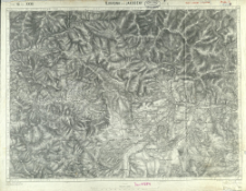
Download allTitle: Ujradna und Jakobeny : Zone 16 Kol. XXXII
Subtitle:
Zone 16 Kol. XXXII : Ujradna und Jakobeny ; Spezialkarte der österreichisch-ungarischen Monarchie 1:75.000. Ujradna und Jakobeny : Zone 16 Kol. XXXII
Publisher:
Place of publishing:
Description:
2. Ausgabe ; Skala 1:75 000 ; 1 mapa ; 38 x 52 cm, na arkuszu 42 x 54 cm ; Południk zerowy Ferro
Type of object:
Relation:
Spezialkarte der österreichisch-ungarischen Monarchie 1:75.000
Detailed Resource Type:
Resource Identifier:
Source:
CBGiOŚ. IGiPZ PAN, sygn. C.583/259 ; click here to follow the link
Language:
Coverage:
(E 24°50'-E 25°20'/N 47°30'-N 47°15').
Rights:
Terms of use:
Digitizing institution:
Instytut Geografii i Przestrzennego Zagospodarowania Polskiej Akademii Nauk
Original in:
Projects co-financed by:
Access:
Object collections:
- Digital Repository of Scientific Institutes > Partners' collections > Institute of Geography and Spatial Organization PAS (IGiPZ PAN) > Library
- Digital Repository of Scientific Institutes > Partners' collections > Institute of Geography and Spatial Organization PAS (IGiPZ PAN) > Library > Maps and atlases
- Digital Repository of Scientific Institutes > Literature > Maps/Atlases
Last modified:
May 12, 2021
In our library since:
Jan 22, 2021
Number of object content downloads / hits:
43
All available object's versions:
https://rcin.org.pl./publication/177405
Show description in RDF format:
Show description in RDFa format:
Show description in OAI-PMH format:
| Edition name | Date |
|---|---|
| Zone 16 Kol. XXXII. Ujradna und Jakobeny, 1914 | May 12, 2021 |
Objects Similar
Dokaupil, Roman (18...- 19...). Redaktor Straka, J. Redaktor Bloschitz, Rudolf Macoun, V. Redaktor
Karbiutz, F. Redaktor Halla, R. (18..-19..). Redaktor Kaiserlich-Königliches Militär-Geographisches Institut (Wiedeń). Wydawca
Meier, J. Karbiutz, F. Redaktor Kaiserlich-Königliches Militär-Geographisches Institut (Wiedeń). Instytucja sprawcza Wydawca
Karbiutz, F. Redaktor Udalri, Anton (18..-19..). Redaktor Wagner, W.
Wojskowy Instytut Geograficzny (Warszawa). Wydawca. Drukarz

 INSTYTUT ARCHEOLOGII I ETNOLOGII POLSKIEJ AKADEMII NAUK
 INSTYTUT BADAŃ LITERACKICH POLSKIEJ AKADEMII NAUK
 INSTYTUT BADAWCZY LEŚNICTWA
 INSTYTUT BIOLOGII DOŚWIADCZALNEJ IM. MARCELEGO NENCKIEGO POLSKIEJ AKADEMII NAUK
 INSTYTUT BIOLOGII SSAKÓW POLSKIEJ AKADEMII NAUK
 INSTYTUT CHEMII FIZYCZNEJ PAN
 INSTYTUT CHEMII ORGANICZNEJ PAN
 INSTYTUT FILOZOFII I SOCJOLOGII PAN
 INSTYTUT GEOGRAFII I PRZESTRZENNEGO ZAGOSPODAROWANIA PAN
 INSTYTUT HISTORII im. TADEUSZA MANTEUFFLA POLSKIEJ AKADEMII NAUK
 INSTYTUT JĘZYKA POLSKIEGO POLSKIEJ AKADEMII NAUK
 INSTYTUT MATEMATYCZNY PAN
 INSTYTUT MEDYCYNY DOŚWIADCZALNEJ I KLINICZNEJ IM.MIROSŁAWA MOSSAKOWSKIEGO POLSKIEJ AKADEMII NAUK
 INSTYTUT PODSTAWOWYCH PROBLEMÓW TECHNIKI PAN
 INSTYTUT SLAWISTYKI PAN
 SIEĆ BADAWCZA ŁUKASIEWICZ - INSTYTUT TECHNOLOGII MATERIAŁÓW ELEKTRONICZNYCH
 MUZEUM I INSTYTUT ZOOLOGII POLSKIEJ AKADEMII NAUK
 INSTYTUT BADAŃ SYSTEMOWYCH PAN
 INSTYTUT BOTANIKI IM. WŁADYSŁAWA SZAFERA POLSKIEJ AKADEMII NAUK


